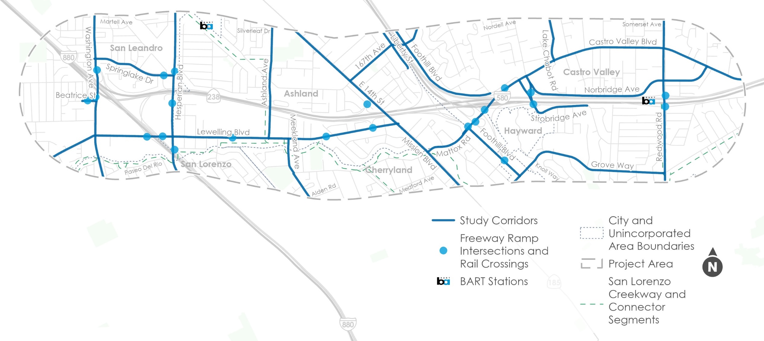
The 4CP aims to make it easier and safer to travel around portions of San Leandro, San Lorenzo, Ashland, Cherryland, and Castro Valley that are currently divided by significant freeway infrastructure. The plan will recommend community-prioritized transportation projects and outline strategies to advance the highest priority improvements in the near-term.
The map below shows the 4CP study area limits, and highlights key corridors, freeway ramp intersections, and rail crossings.
To learn more about the 4CP, please visit Alameda CTC's project website.
For questions on the 4CP, please email contact@alamedactc.org. For language assistance, please call (510) 208-7475.
To view this page in another language, please click on the language button in the top right corner and select your language of choice from the menu.
Community Survey
Thank you to all who came to our events! If you weren't able to make it, take our survey below to give your input on transportation improvement ideas.
The survey below shows potential improvement ideas for the entire study area first, and then offers the ability to provide feedback on potential improvement ideas for each of the 4CP's ten priority corridors. Your feedback on these ideas and their tradeoffs will help us develop more specific project recommendations which will be shared in the 4CP's third and final round of public outreach, anticipated later this year. At the bottom of the survey, you'll see a set of optional demographics questions.
INSTRUCTIONS:
- You do not have to complete the survey for all ten priority streets - feel free to only answer questions for the streets you're most familiar with.
- Make sure to click SUBMIT at the bottom to record your response!
Survey closes June 12, 2026 at 11:59pm.


