Welcome to the virtual learning and feedback tour for the City of Hayward Safe Streets Downtown project!
The City of Hayward heard from you and is advancing two long-term options for the future of Downtown Hayward, and they need your help deciding which direction to take.
These are not final designs; they are ideas meant to spark discussion and help us understand what the community values most. The team will use your input to shape a preferred alternative that will be shared with City Council as the next step toward grant funding and future design work.
How to Participate
This survey is organized as a short self-guided tour. Steps 1–4 are the most important—please complete those first. If you have extra time, feel free to explore the later steps for additional context.
Step 1: Review project goals
Step 2: Review Long Term Option 1 - Note: This is option 1 of 2 long term visions being explored
Step 3: Review Long Term Option 2 - Note: This is option 2 of 2 long term visions being explored
Step 4: Share your thoughts on the contents in Steps 1–3
If you have more time:
Step 5: Review alternatives for B Street and provide your feedback on the proposed designs.
Step 6: Review alternatives for C Street and provide your feedback on the proposed designs.
Step 1: Goals
Keep these goals in mind as you move through each of the steps.
The primary project goal is to:
![]()
Create Safer Streets
Eliminate severe injury and fatal collisions on the Loop and in Downtown Hayward
In addition, the project has three other important goals:
Promote Economic Enable a thriving business |
Instill Equity in Prioritize projects focused on |
Position the City Develop projects that are |
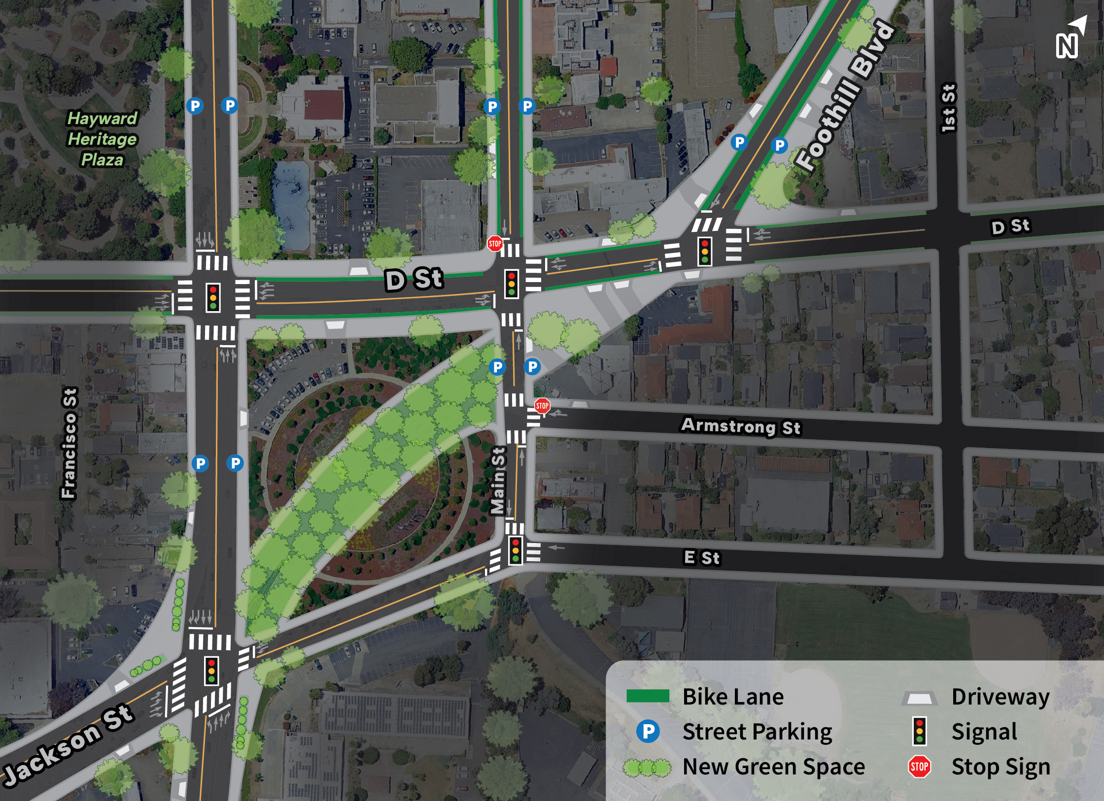
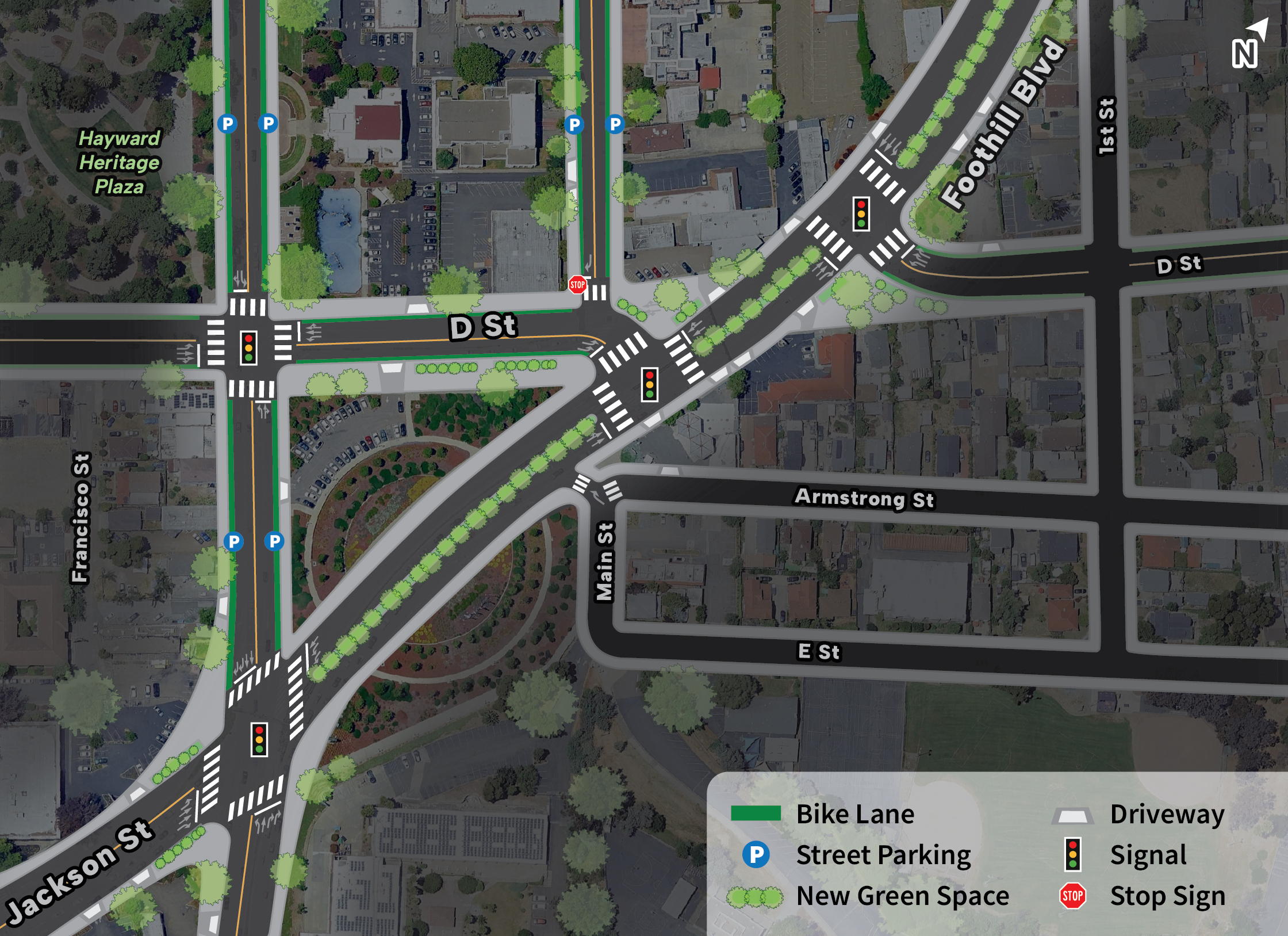
Step 2: Long Term Option 1 (Downtown Grid)
The City has developed two long-term options for the future of Downtown Hayward.
The materials below present Option 1 (Downtown Grid) of the long-term vision. In this section, you’ll find:
- How people would move through the downtown – an overview of circulation and street layout of key intersections
- What this design could look like – two illustrative views of Mission Blvd and Foothill Blvd
- Choices and trade-offs – what this option prioritizes and what it may give up
- How this option connects to Mission Blvd and Foothill Blvd – how it fits into the broader street network
Please review these details carefully, and be sure to explore Option 2 (Step 2) before moving to Step 4 to provide your input.
How People Would Move Through Downtown
This section illustrates how people would move through Downtown streets, highlighting proposed circulation patterns and the street layout of A Street, Mission Blvd, and Foothill Blvd by illustrating how vehicles, people walking, and people bicycling navigate the corridor.
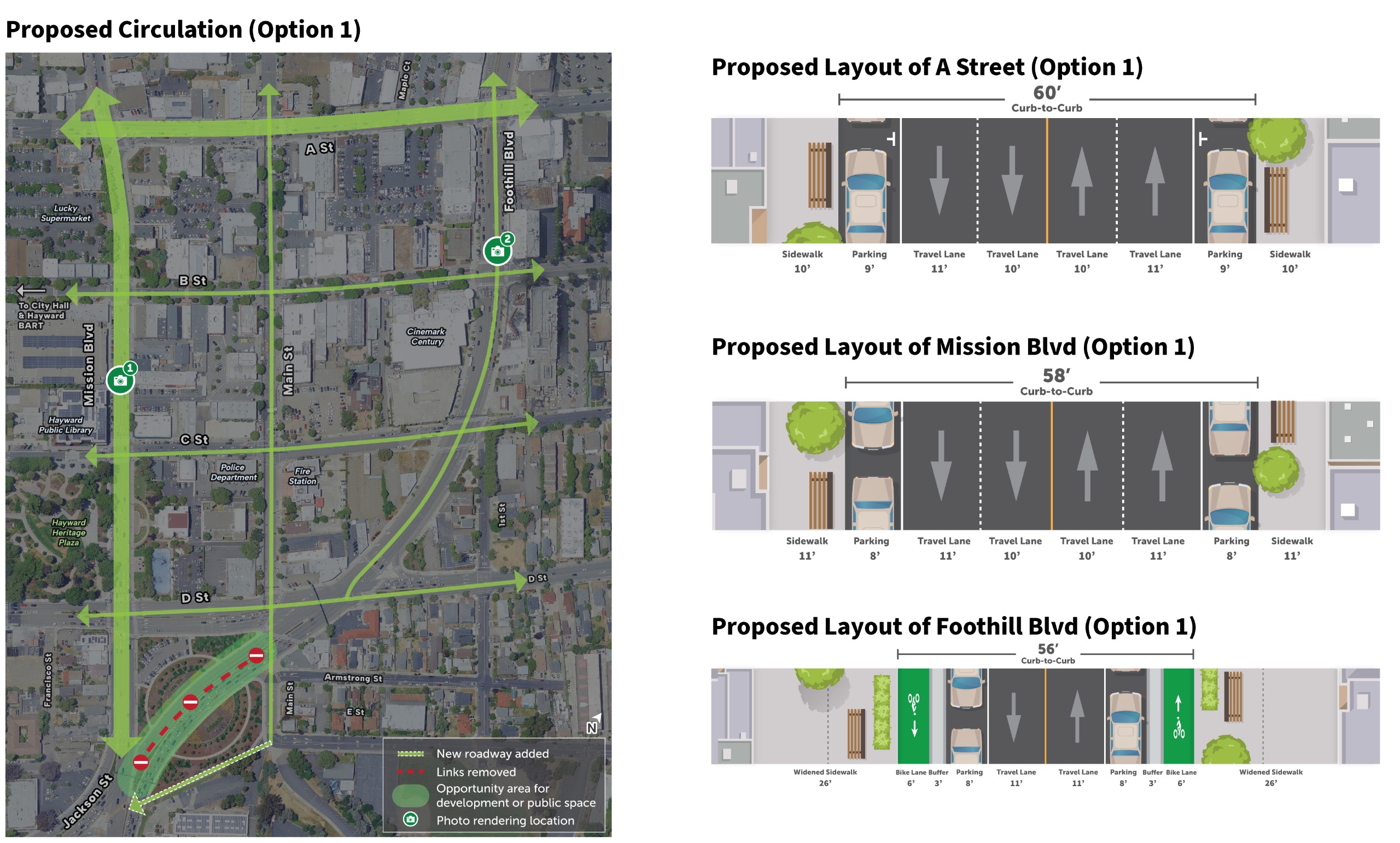
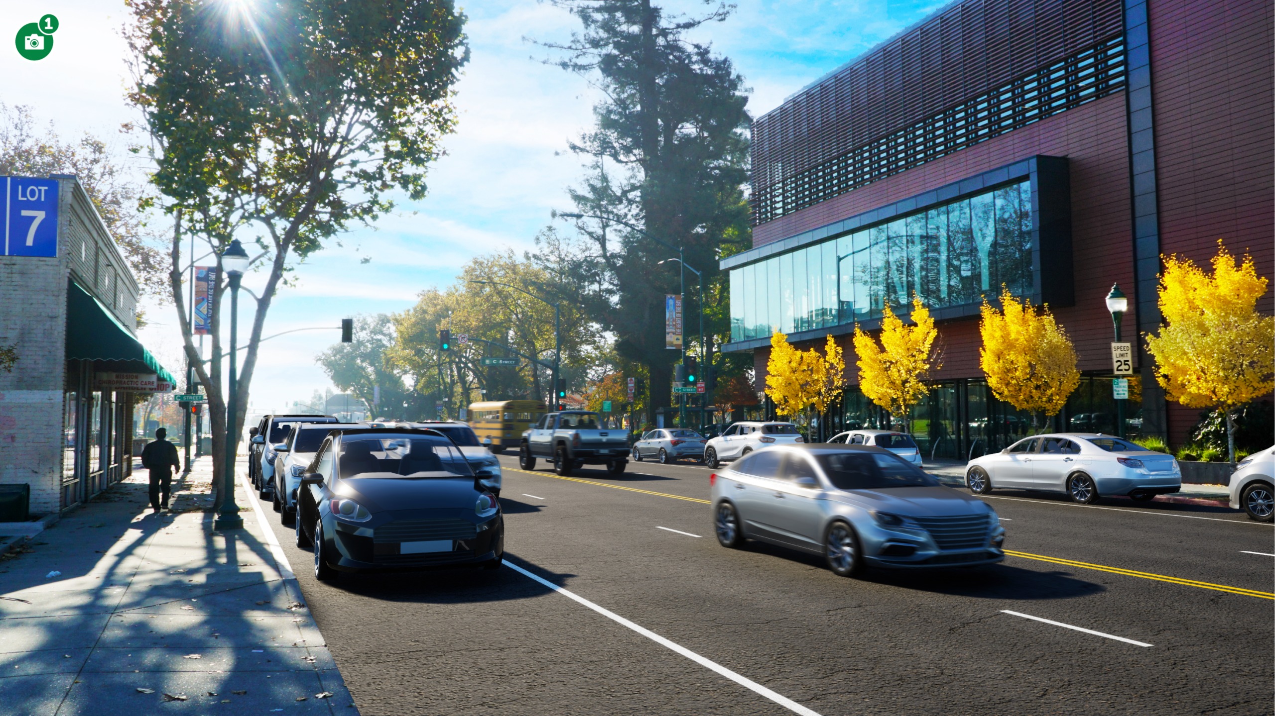
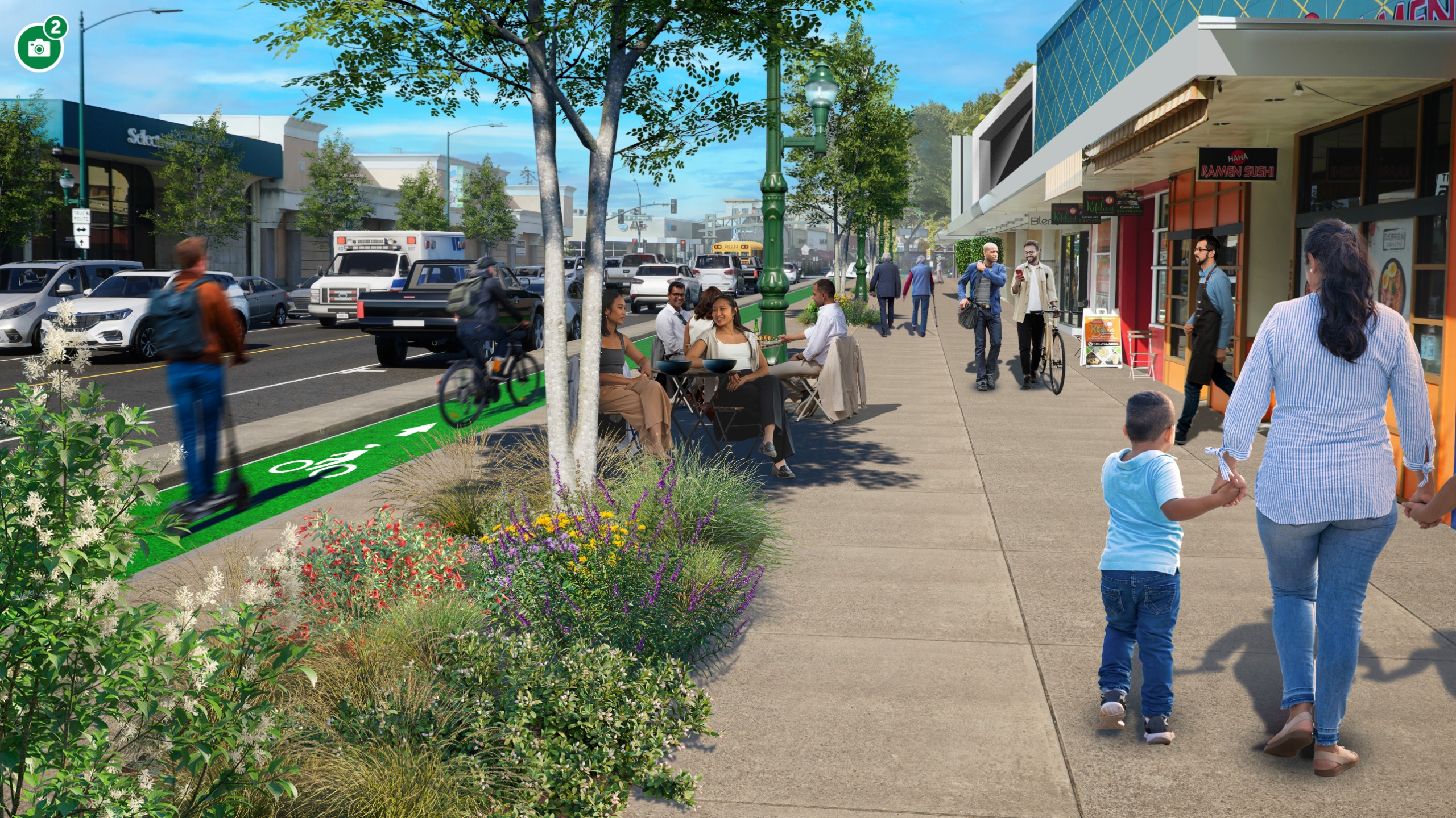
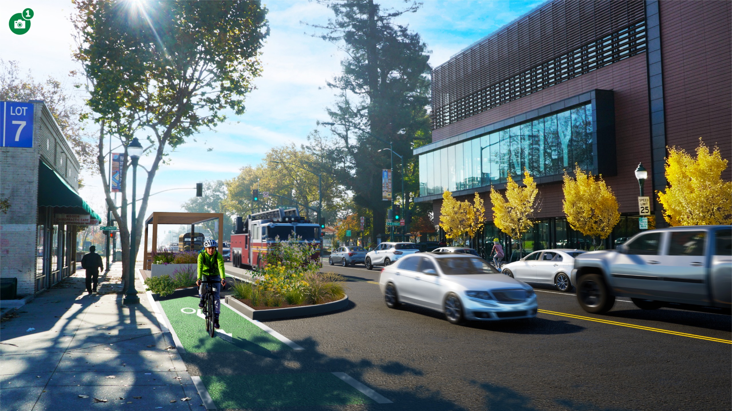
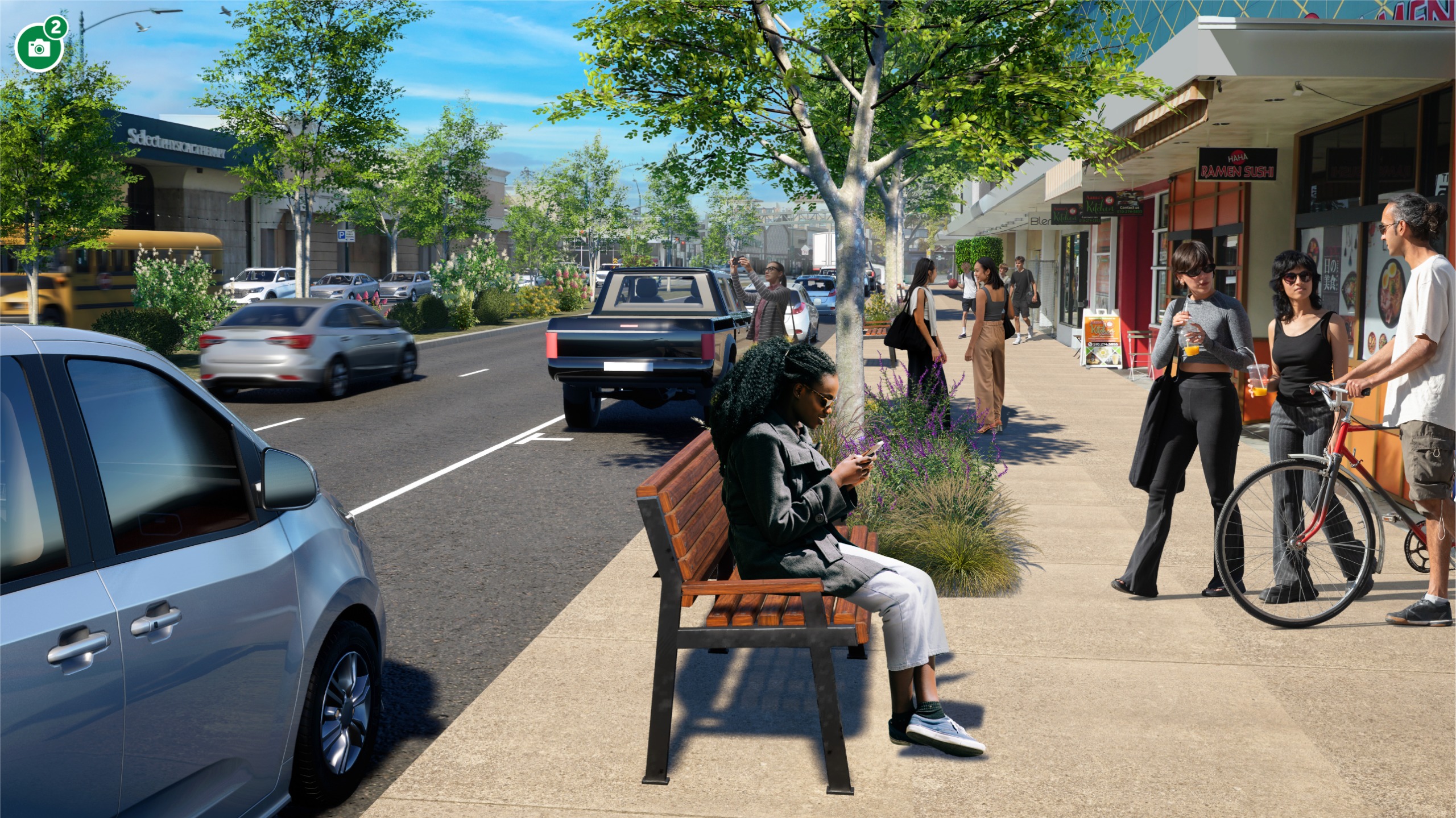
 What This Design Could Look Like
Image 1 of 2
Choices and Trade-offs
Under Option 1, people and traffic would move through downtown in different ways. This section summarizes how movement occurs today and the potential changes:
Today
- The loop today experiences modest levels of delay, which encourages its use for through travel and high speeds
Option 1
- Most paths through downtown require vehicles to make multiple turns, increasing overall congestion
- Congestion increases significantly on loop streets compared to the baseline, even in the scenario where most through traffic (about 20% of traffic) chooses a different route
- Building a grid creates new connections that enable through vehicle trips to use more roads in downtown to make connections, increasing traffic on several streets
- Reduced capacity on the Loop creates a diversion risk (up to 1,200 vehicles northbound in the PM peak hour), with most rerouted traffic expected to use the new connection from Jackson Street to E Street and 2nd Street (up to 700 vehicles northbound in the PM peak hour).
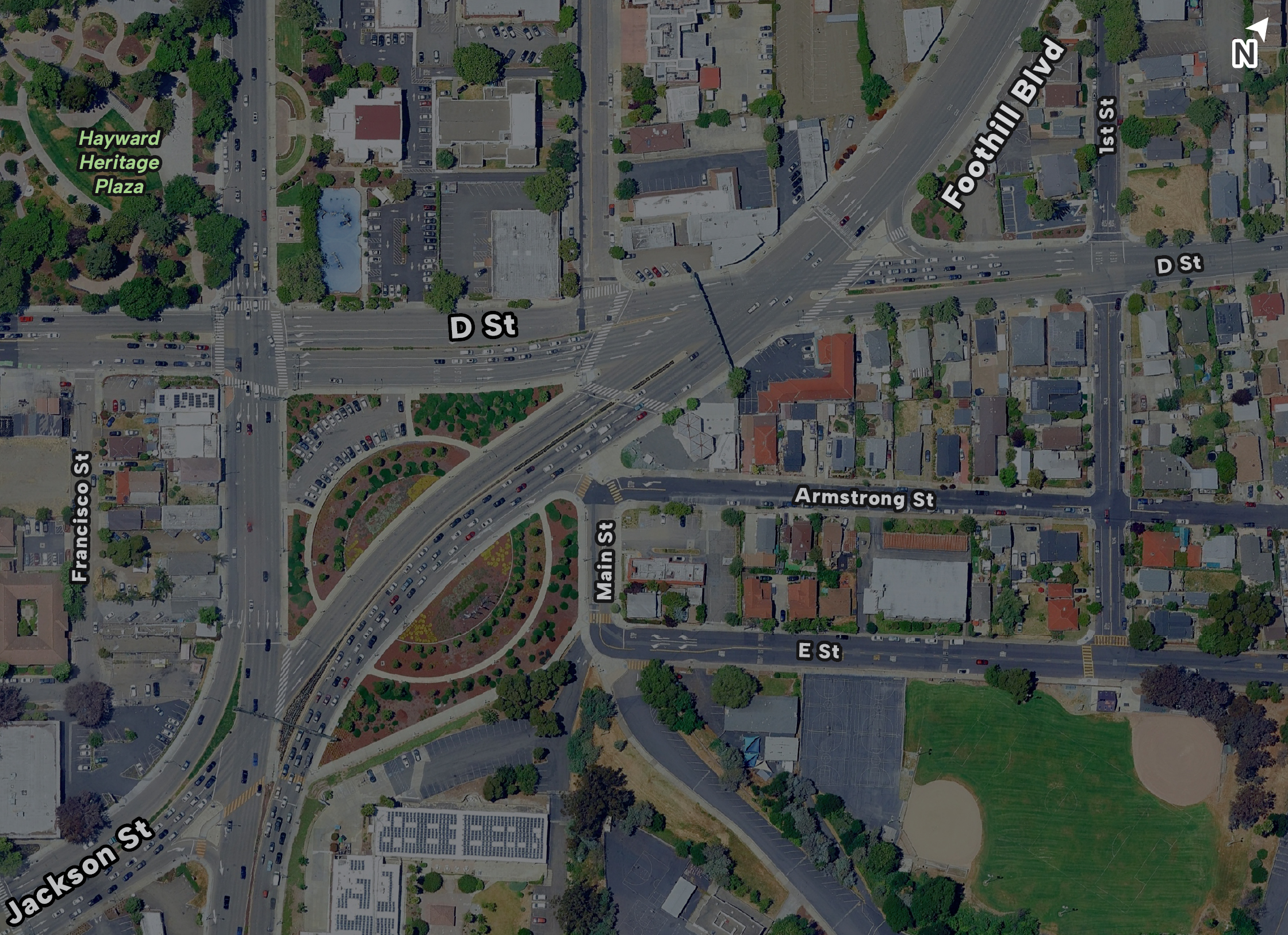
How This Option Connects to Mission Blvd and Foothill Blvd
New roadway connecting Main St to Jackson St
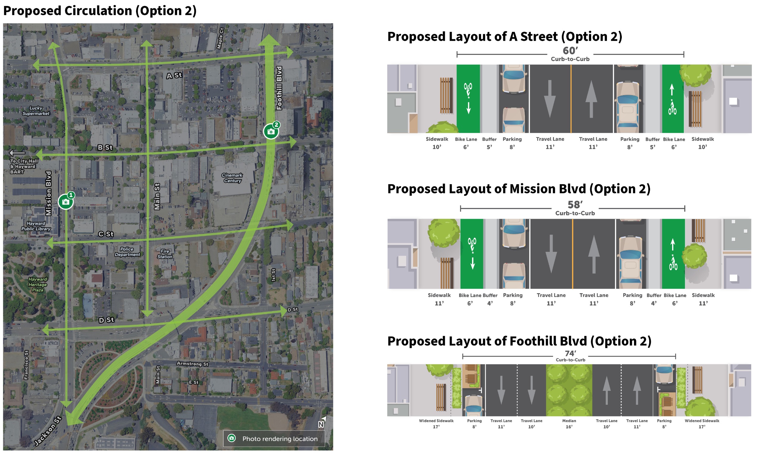
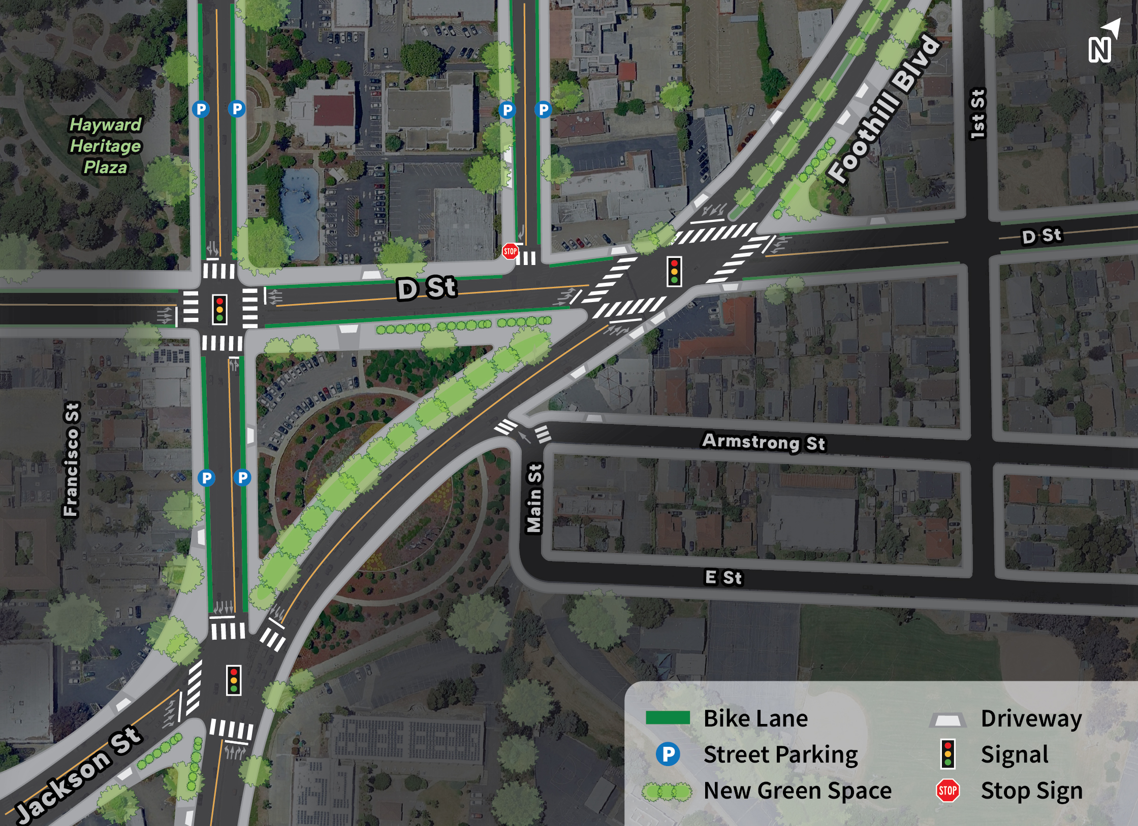
Step 3: Long Term Option 2 (Civic Avenue)
The materials below present Option 2 (Civic Avenue) of the long-term vision. In this section, you’ll find:
- What this design could look like – two illustrative views of key streets
- How people would move through the street – an overview of circulation and street layout of A Street, Mission Blvd, and Foothill Blvd.
- Choices and trade-offs – what this option prioritizes and what it may give up
- How this option connects to Mission Blvd and Foothill Blvd – how it fits into the broader street network
Please review these details carefully, and be sure to explore Option 1 (Step 2) before moving to Step 4 to provide your input.
How People Would Move Through Downtown
This section illustrates how people would move through Downtown streets, highlighting proposed circulation patterns and the street layout of A Street, Mission Blvd, and Foothill Blvd by illustrating how vehicles, people walking, and people bicycling navigate the corridor.
What This Design Could Look Like
Image 1 of 2
Choices and Trade-offs
Under Option 2, people and traffic would move through downtown in different ways. This section summarizes how movement occurs today and the potential changes:
Today
- The loop today experiences modest levels of delay, which encourages its use for through travel and high speeds
Option 2
- Prioritizing through travel on Foothill Boulevard creates an opportunity for Mission Blvd and cross streets to be more oriented towards local travel
- Reduced capacity on the Loop creates a diversion risk (up to 1,200 vehicles northbound in the peak hour), with the potential routes impacted including 2nd Street (about 1/3 of traffic) and Grand Avenue and parallel streets to the west (about 1/3 to half of traffic).
- A small portion (around 10%) would be expected to use the freeway system instead (I-880 and I-238). Planned complete streets improvements to local streets (such as the Downtown Bike Loop and East Bay Greenway) will help shift more traffic from nearby streets to the freeways
- Congestion increases slightly in the loop compared to the baseline, but the system continues to operate with reasonable delay in the peak period, even if all traffic remains on loop streets.
How This Option Connects to Mission Blvd and Foothill Blvd
Idea A: D St split into two "T" intersections at Foothill Blvd
Idea B: D St continues straight through downtown
Step 4: Tell us what you think!
Now that you've reviewed Steps 1-3 and both long-term vision options, please share your thoughts on these options.
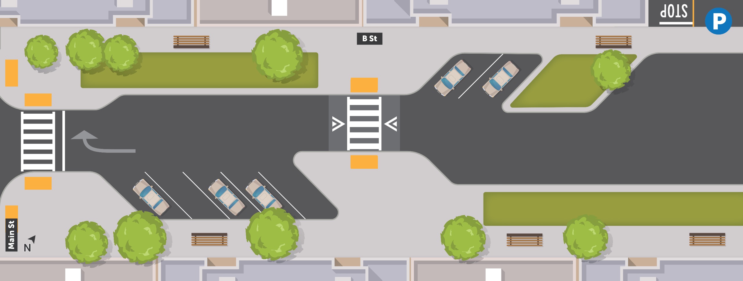
Step 5: B Street
Reimagining B Street
For this corridor, the City is presenting three design options, each offering a different way to experience B Street. We heard in the design charrette a desire to prioritize B Street for pedestrian access to local businesses. All three of the options below are designed to reduce vehicle speeds and through vehicle travel, while retaining local access to businesses and parking. Help identify which option you think best achieves these goals.
Below, you’ll find an overview of three proposed design configurations. These can be combined with either of the long-term options from Step 2 and Step 3 (Downtown Grid or Civic Avenue).
B Street Option 1: Keep One-Way
| In this option:
|
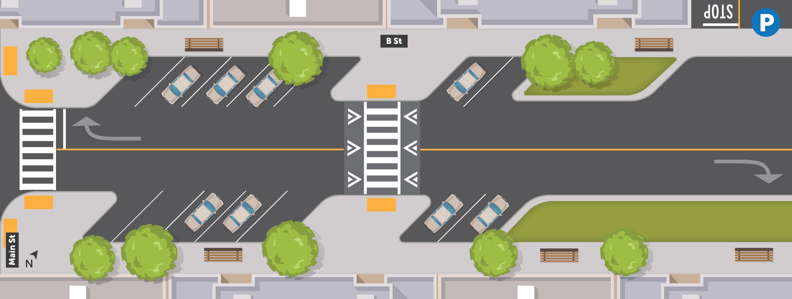
B Street Option 2: Change to Two-Way
| In this option:
|
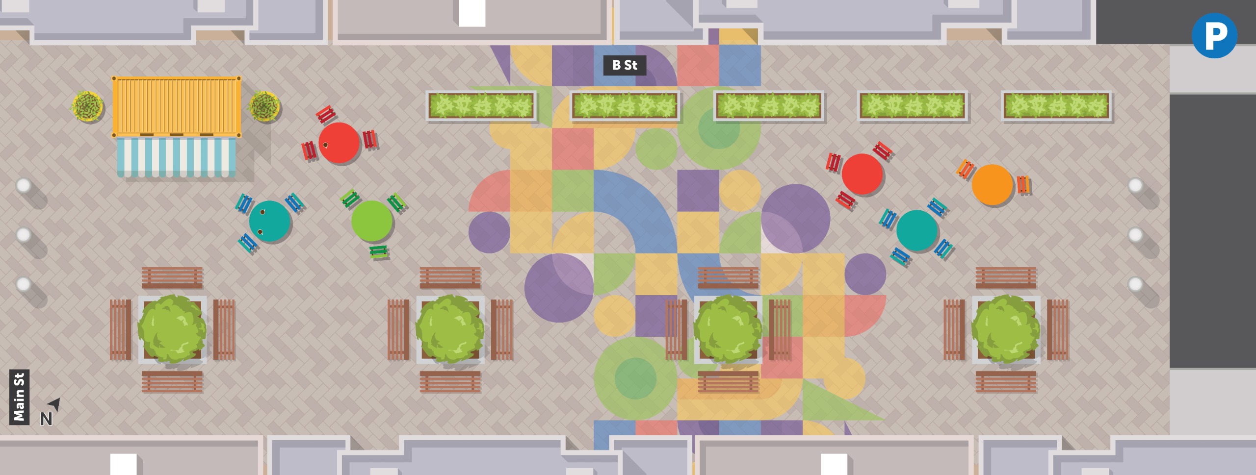
B Street Option 3: Pedestrian Plaza between Main St and Parking Lot
| In this option:
|
Step 6: C Street
C Street is an important east–west connection in Downtown Hayward, providing access to key destinations including the Hayward Public Library, the BART Station, and Municipal Parking Lot #3.
For this corridor, we are presenting one proposed design option. Before moving forward, we want to ensure the design reflects community needs and that we haven’t overlooked any opportunities.
Below, you’ll find:
- An overview of the planned circulation for C Street, and
- The proposed street configuration for two distinct segments of the corridor.
We welcome your input and feedback on the proposed design at the bottom of the page.
C Street Circulation
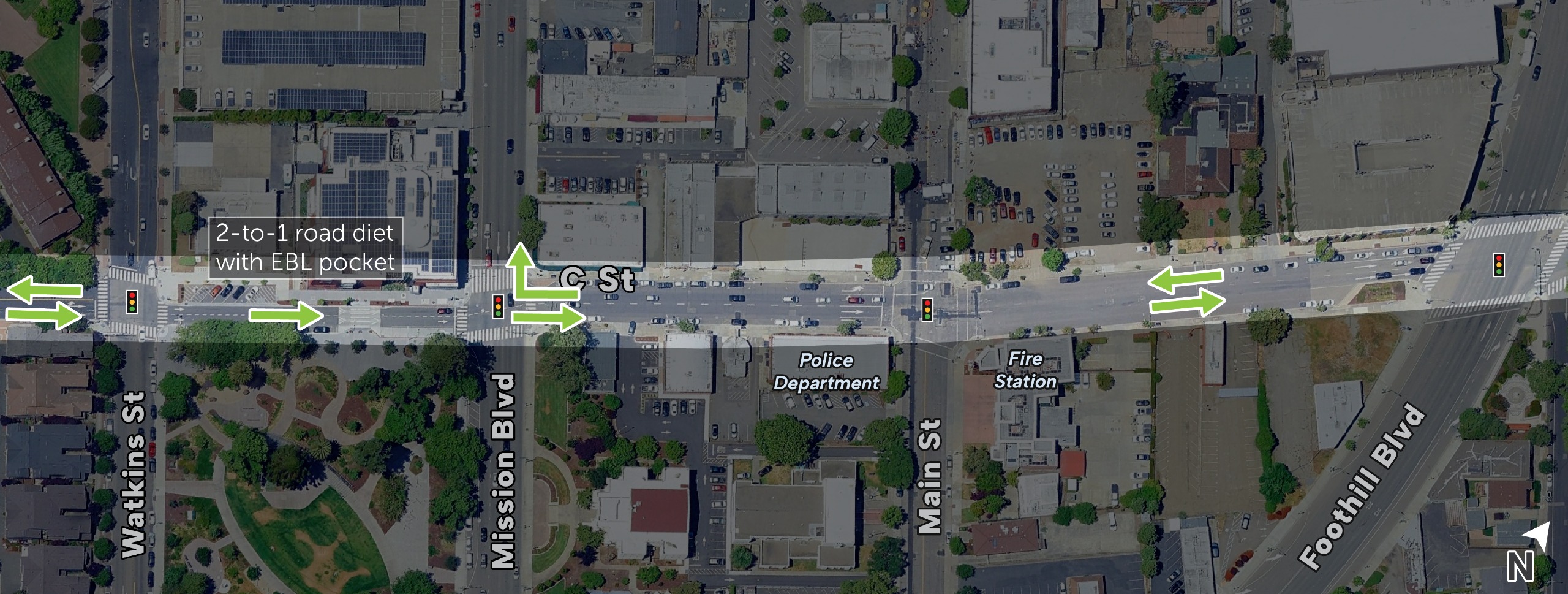
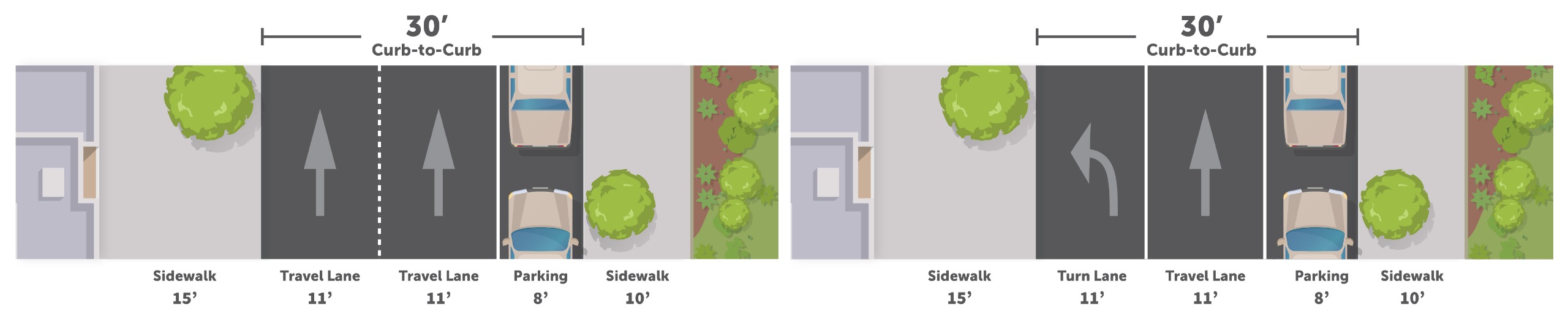
C Street between Watkins St & Mission Blvd
Existing (left) & Proposed (right)
The graphics below illustrate existing conditions of C Street between Watkins Street & Mission Blvd, and proposed conditions that includes repurposing one through travel lane into a turn lane.
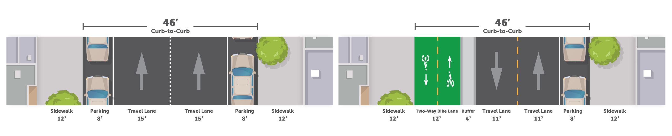
C Street between Mission Blvd & Foothill Blvd
Existing (left) & Proposed (right)
The graphics below illustrate existing conditions of C Street between Mission Blvd & Foothill Blvd, and proposed conditions with a Two-Way Class IV Separated Bikeway, in alignment with the Bicycle & Pedestrian Master Plan.
Considerations
Proposed Design
- Watkins and Mission block remains one-way, with left turns allowed onto Mission to improve access to local businesses and for buses to return to Mission.
- C Street between Mission and Foothill is converted to two-way travel with narrower travel lanes, which improves circulation and slows vehicle speeds. The transition from two-way to one-way at Mission requires traffic signal modifications.
- A two-way separated bike lane between Mission and Foothill provides local business and BART access to, from, and through downtown.


