
Round Three Online Engagement
Round Three Online Engagement
Online engagement will remain open for participation until Friday, June 26th.
Welcome to the third and final round of online engagement for this study.
Over the previous two rounds, we heard about your experiences traveling through the neighborhood, shared analysis with the community, and gathered input on preferred countermeasure approaches.
This final round focuses on understanding which concepts resonate most with you, and hearing your feedback on how they could be improved.
To share input now:
1. Review the concepts
2. Cast your vote
3. Share your ideas
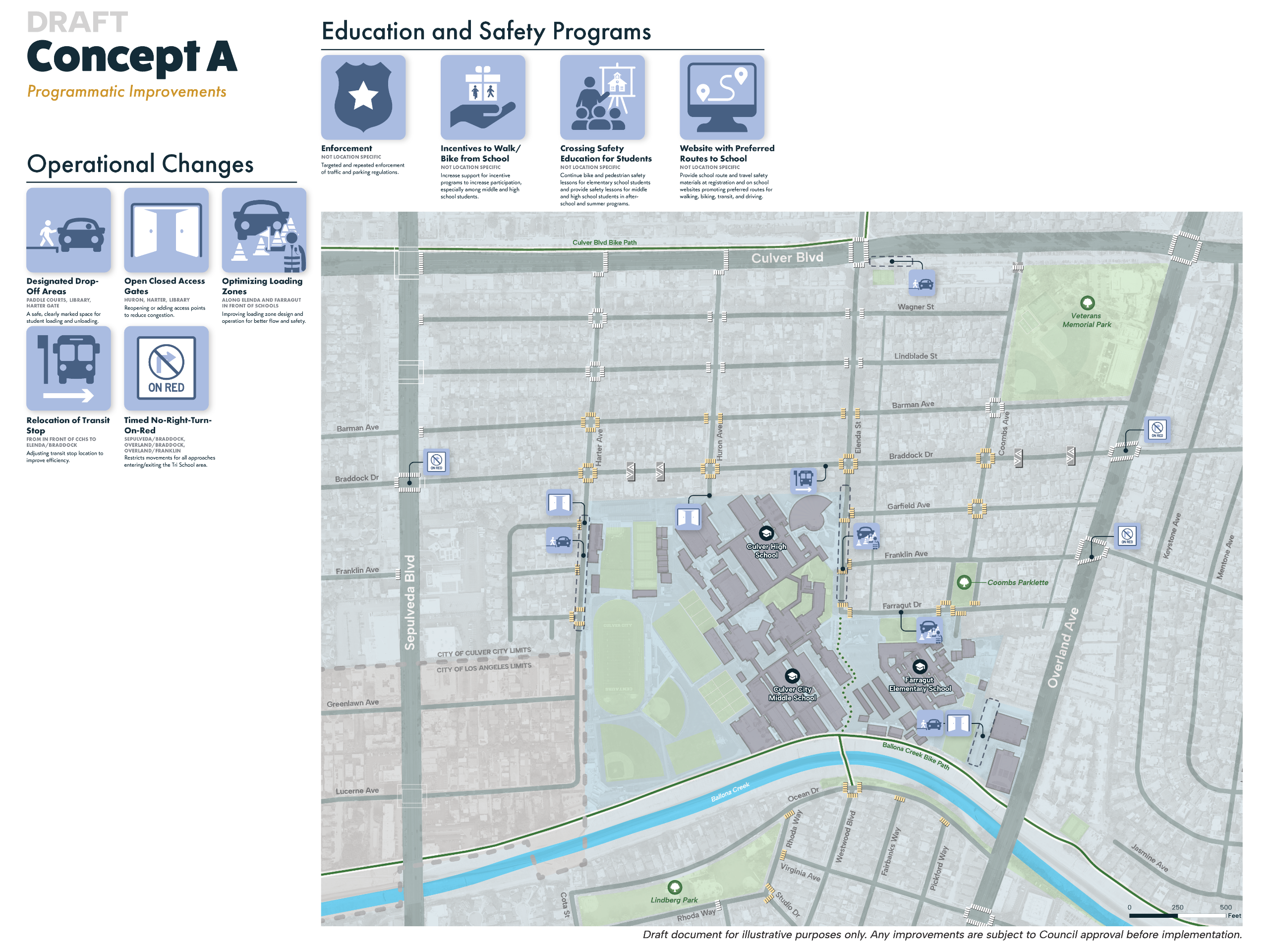
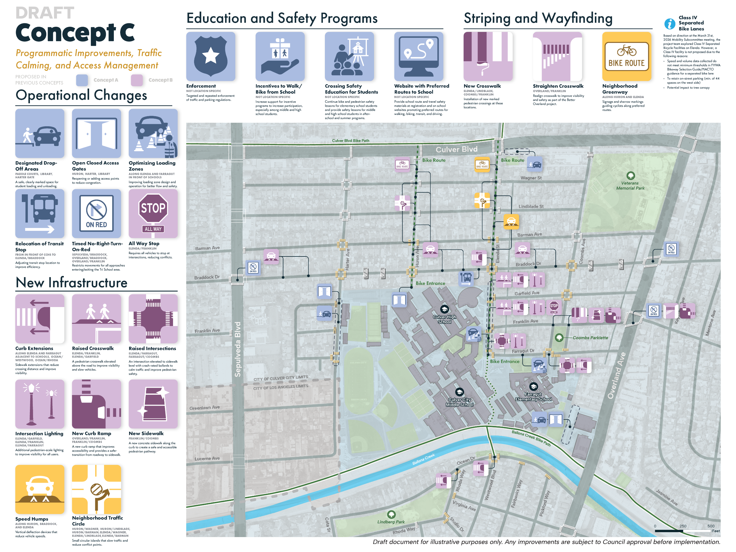
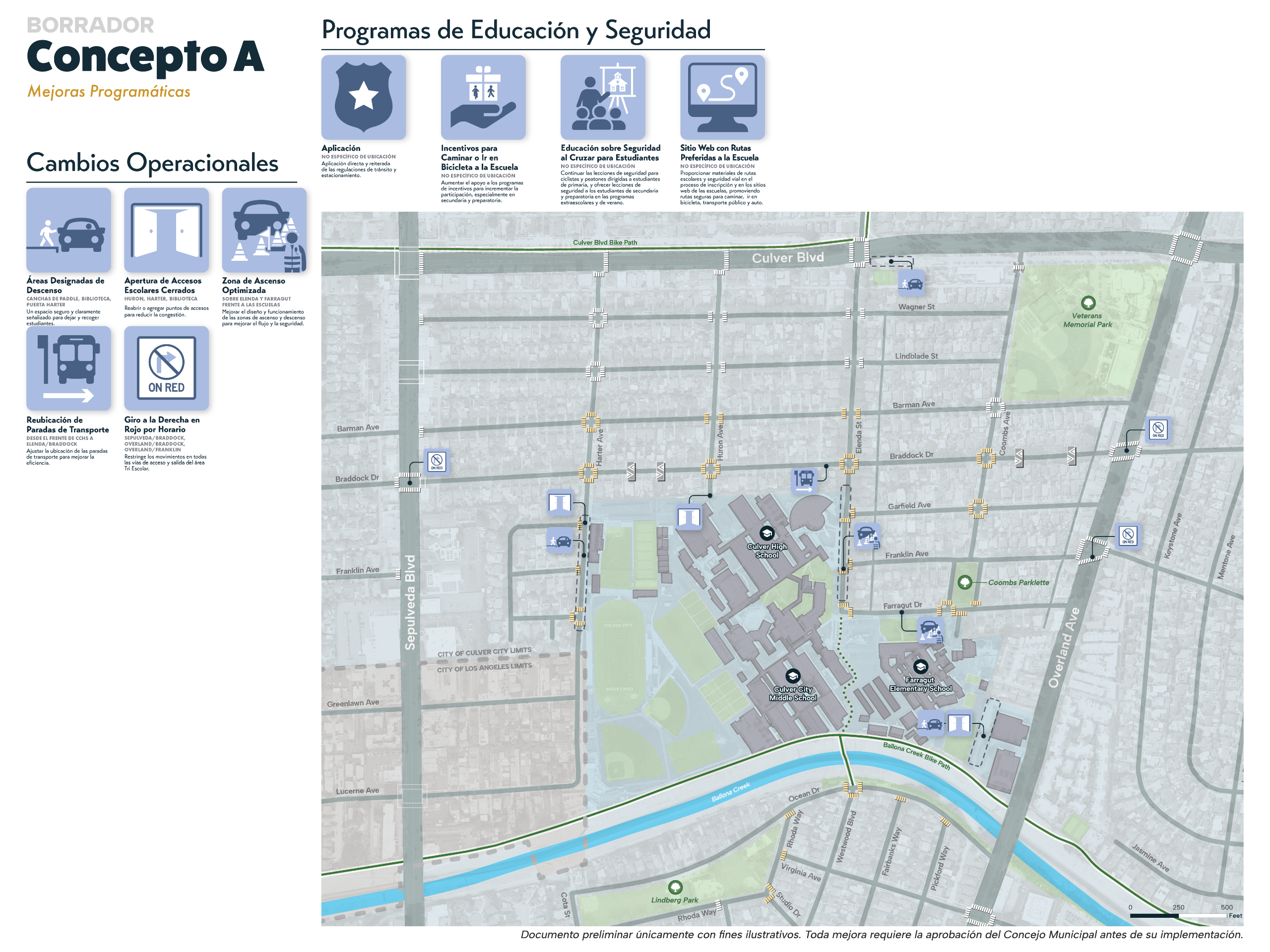
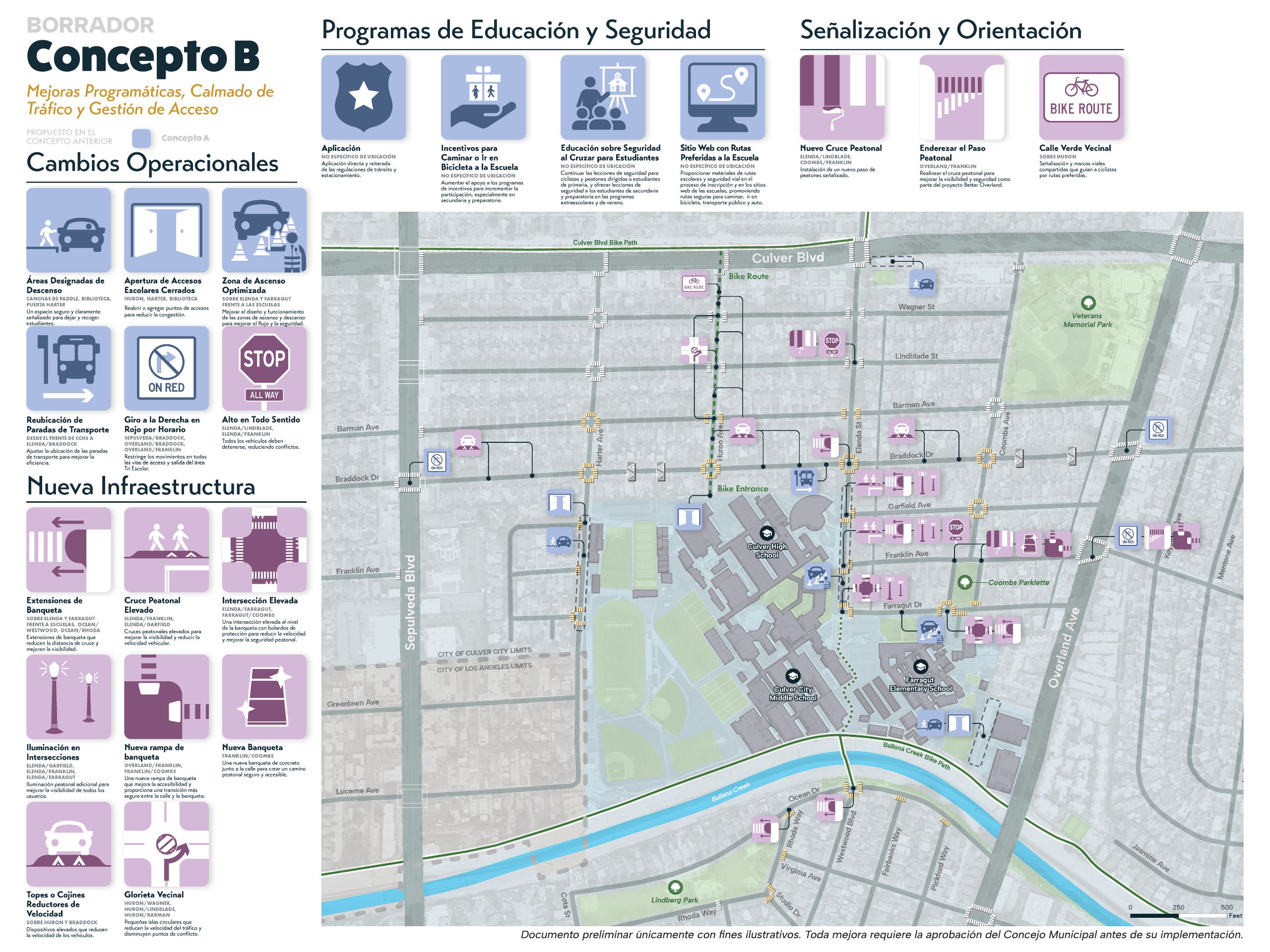
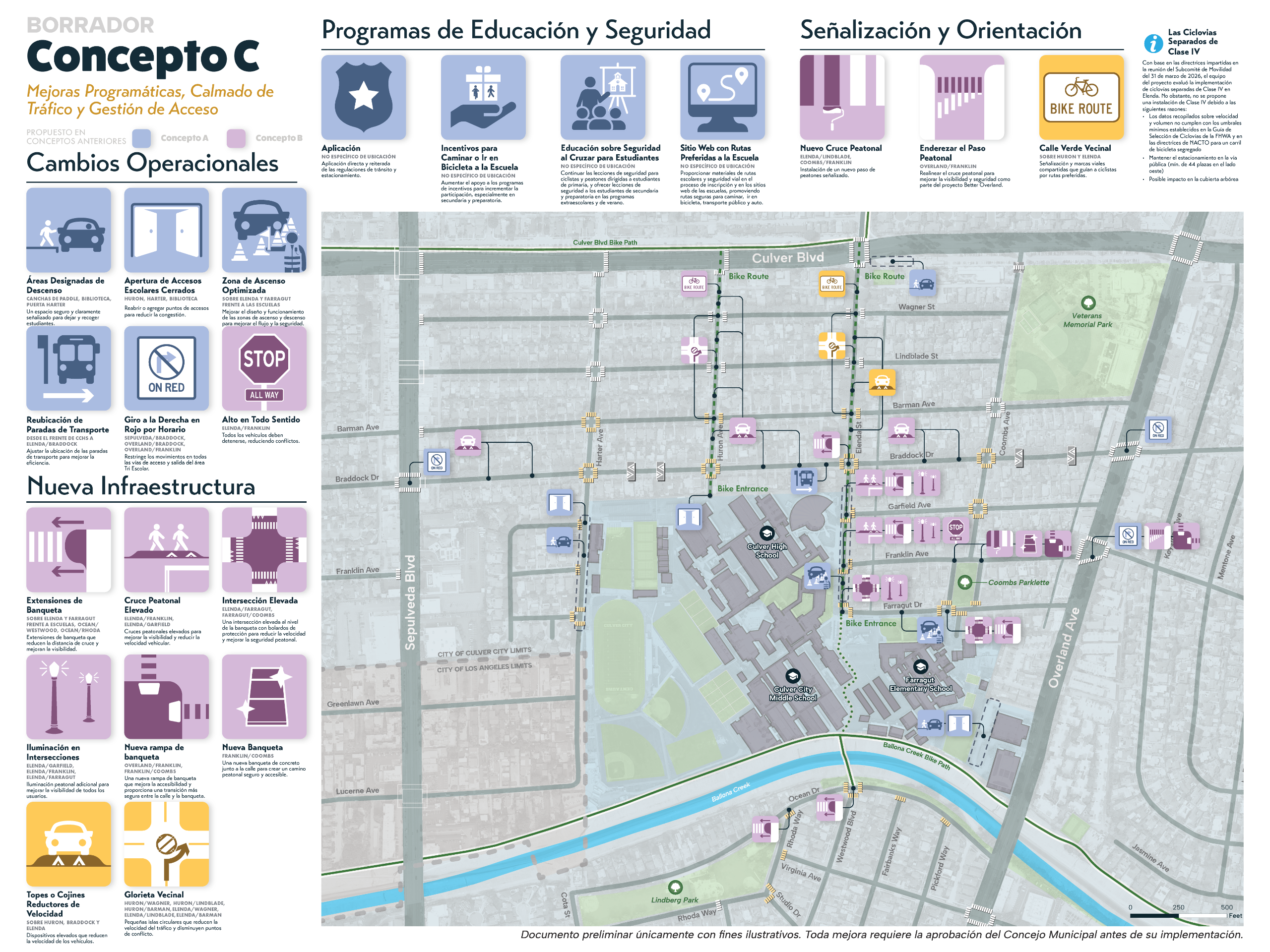
Review the Draft Concepts
Please review each draft concept below before sharing your feedback.
The concepts are designed to build on one another:
- Concept A focuses primarily on programmatic and limited-infrastructure improvements.
- Concept B incorporates everything from Concept A (shown in blue) plus new traffic calming and access management additions shown in pink.
- Concept C includes the same elements as Concepts A and B (shown in blue and pink), and introduces a neighborhood greenway and traffic calming elements along Elenda Street shown in gold.
If you support a concept but have feedback on what is included or what may be missing, you can vote for that concept and leave a comment sharing your ideas.
Image 1 of 6

Draft Concept Files
Project Overview
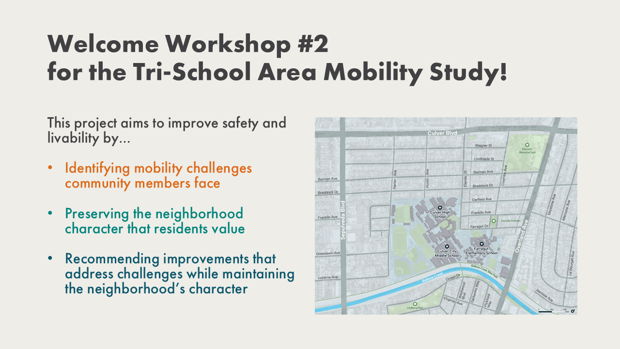
What is the Tri-School Area Mobility Study?
The Tri-School Area Mobility Study is an effort to assess the safety and efficiency of mobility in the area surrounding the Tri-Schools.
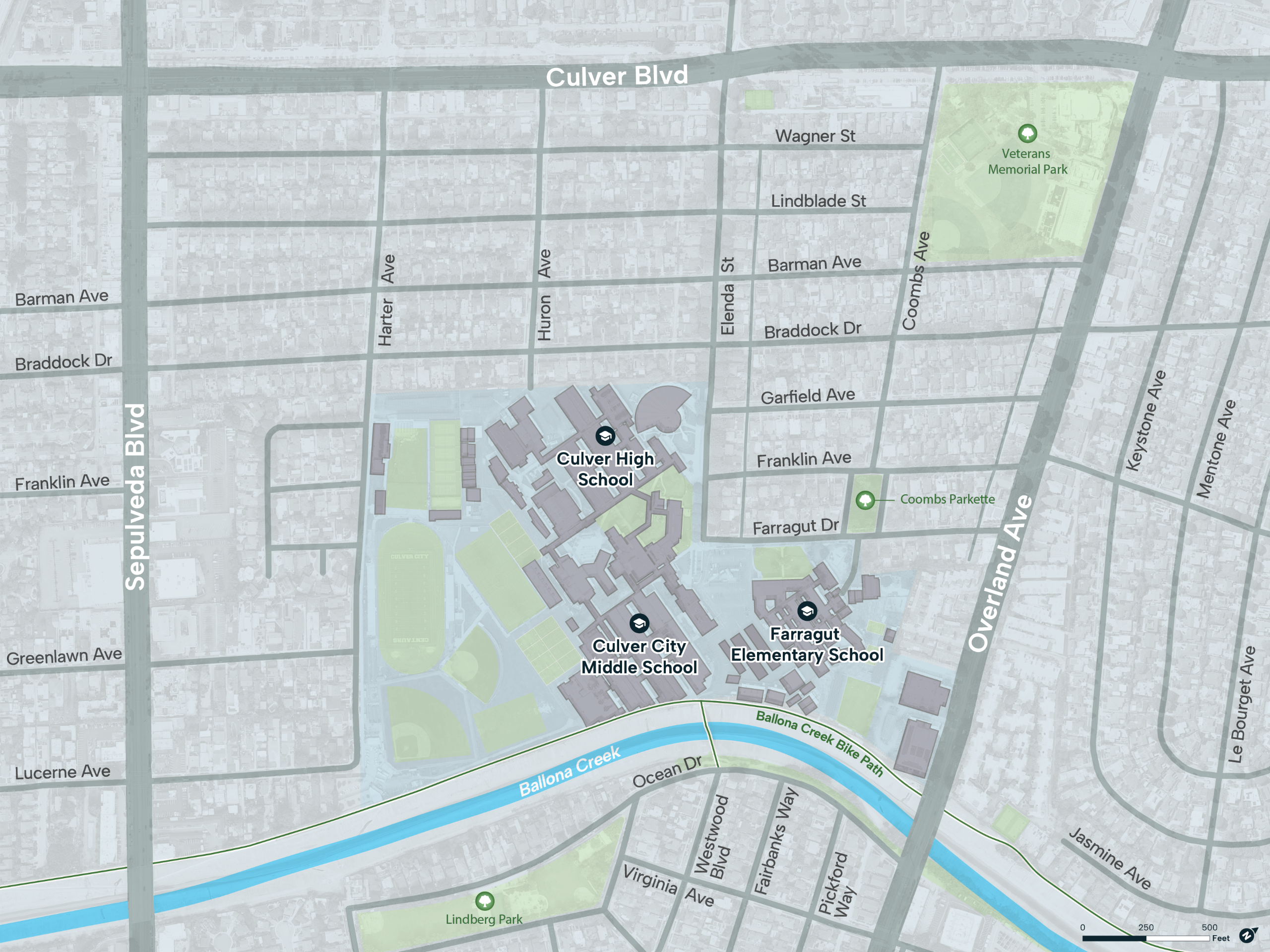
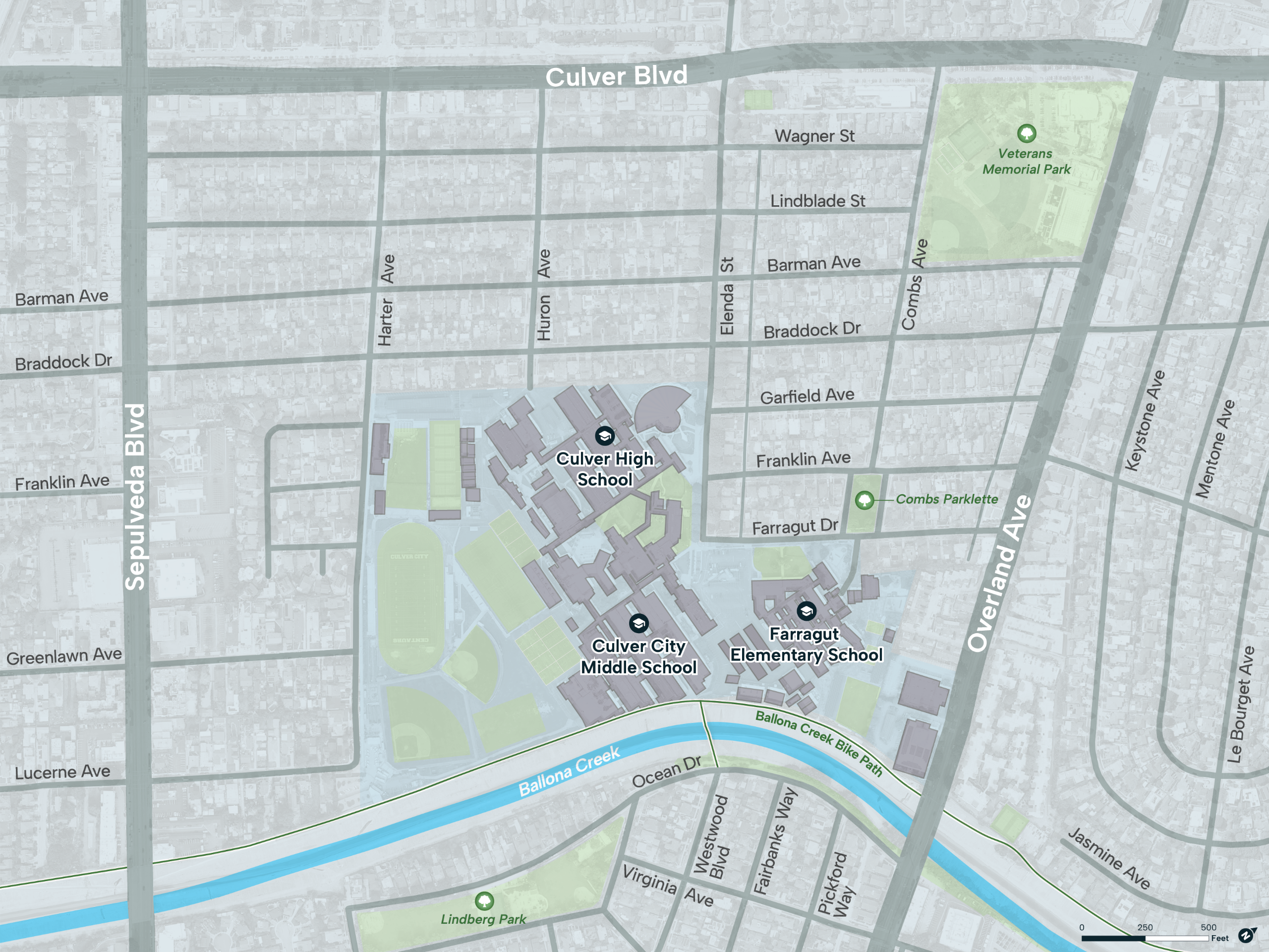
Map of the Culver City Tri-School Area
The study aims to understand the transportation challenges community members face, gather input on potential solutions, and develop improvements that will make the neighborhood’s roadways safer and more comfortable for everyone.
We’re just getting started and want to learn from the mobility experiences of everyone who lives, learns, and travels through the area. The input of the entire Culver City school community, including students and their families across the region, will be essential to the success of this study. After this first round of community engagement and data collection, we will return in the winter with a summary of what we heard and ideas for how these concerns can be addressed.
Engagement Round Three Workshop RSVP (Closed)
Engagement Round Three Workshop RSVP (Closed)
Thank you to everyone who registered for and attended our first community workshop on May 27th! If you missed this workshop or have additional feedback, please feel free to complete the online engagement activities, which will be open until June 26th.
Frequently Asked Questions
Frequently Asked Questions
What improvements are included in this study?
The study is starting with a blank slate. We are currently in the first of three rounds of community input. No specific improvement concepts have been selected. Following this initial outreach phase, the project team will develop a range of possible ideas, which will be shared at upcoming public meetings for review and feedback before any recommendations are developed.
What is the area of the study?
The study is focused on mobility in neighborhoods surrounding Culver City High School, Middle School, and Farragut Elementary School. The area is generally bounded by Culver Boulevard to the north, Overland Avenue to the east, Virginia Avenue to the south, and Sepulveda Boulevard to the west as shown in the map below.
Who is involved in the study?
The City is actively coordinating with all stakeholders, including CCUSD. Throughout this process, the City has been, and will continue, collaborating closely with CCUSD, school leadership, families, and neighborhood residents to explore all possible improvement options, including operational, non-infrastructure, and low-impact infrastructure strategies. This coordination is ongoing and will help ensure that potential concepts reflect the needs and realities of the entire school community.
Will trees be impacted by this study?
Trees will not be removed. The study’s purpose is to assess current mobility conditions and gather community input. It does not propose or assume removal of any street trees or canopy. Maintaining the existing environment, including mature trees, remains a priority.
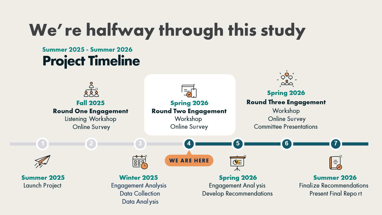
Round Two Online Engagement (Closed)
Round Two Online Engagement
Thank you to everyone who participated in the second round of engagement! We look forward to sharing what we learned as part of the third round of engagement in late Spring 2026.
Online engagement will remain open for participation until Friday, March 27th.
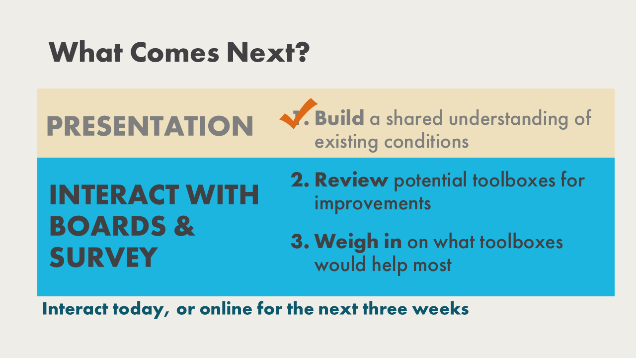
This is the second step in gathering input for the study. In the previous round, we heard about people’s experiences traveling through the neighborhood and have since collected and analyzed additional data.
To share input now:
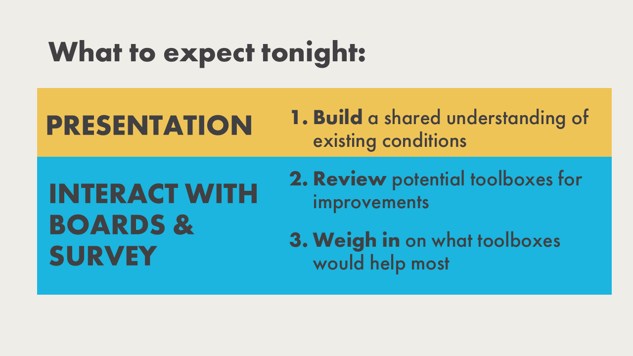
- First, toggle through the workshop presentation to learn what we heard from the community and what we found in the data.
- Next, review the 7 toolboxes to see what tools they include and how they relate to the neighborhood’s challenges.
- Finally, use the survey to prioritize the toolboxes by distributing 100 points across the eight options (seven toolbox categories and “No Changes”). You can also share feedback on tools you like, tools that may be missing, or other comments.
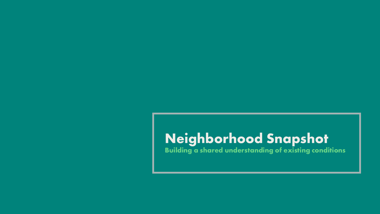
Step One: What We've Learned So Far
Toggle through the presentation from the workshop to learn more about what we heard in the first round and what we found in data analysis...
Image 1 of 24
Note: Presentation Updated on 3/18/26
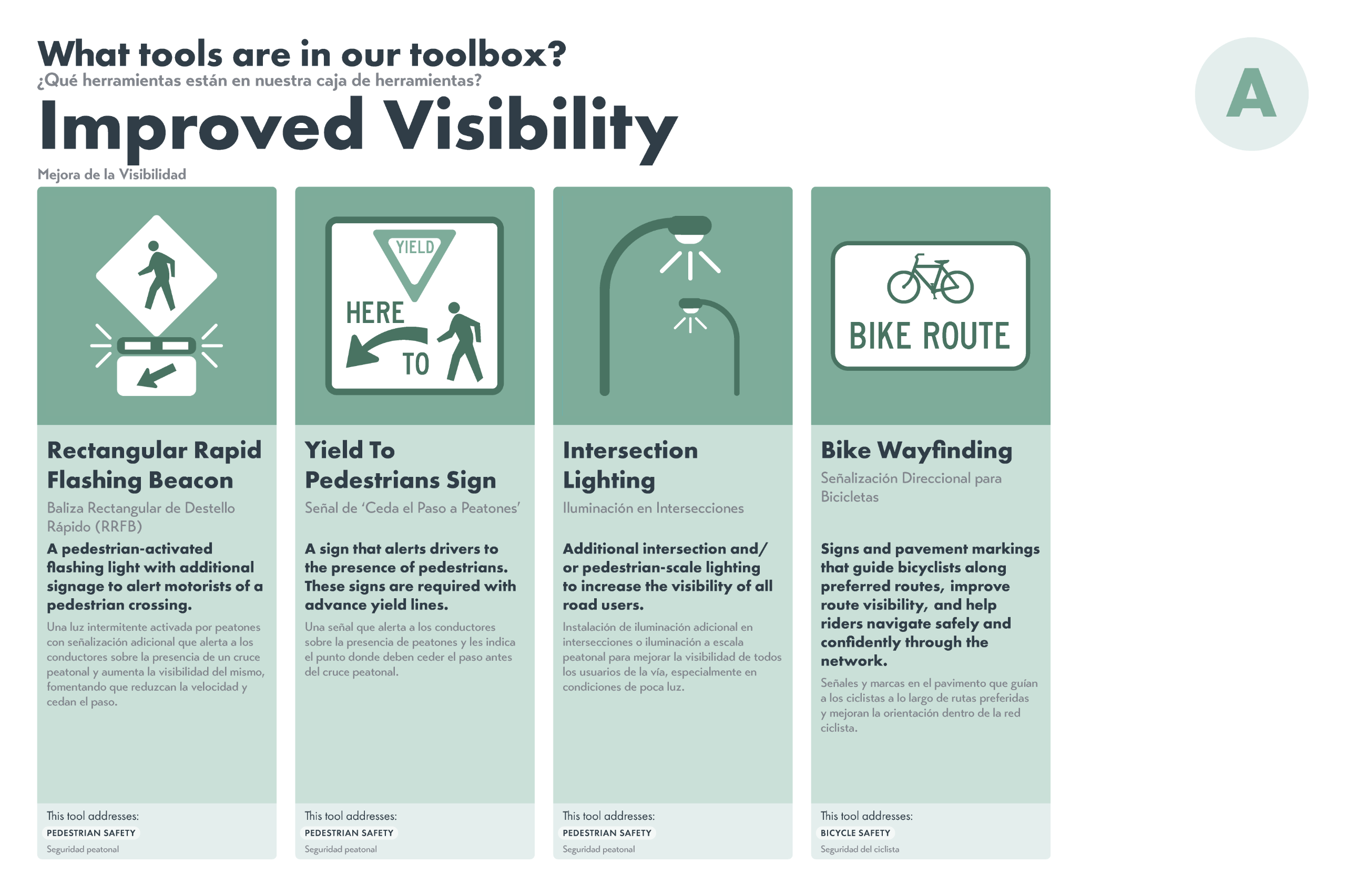
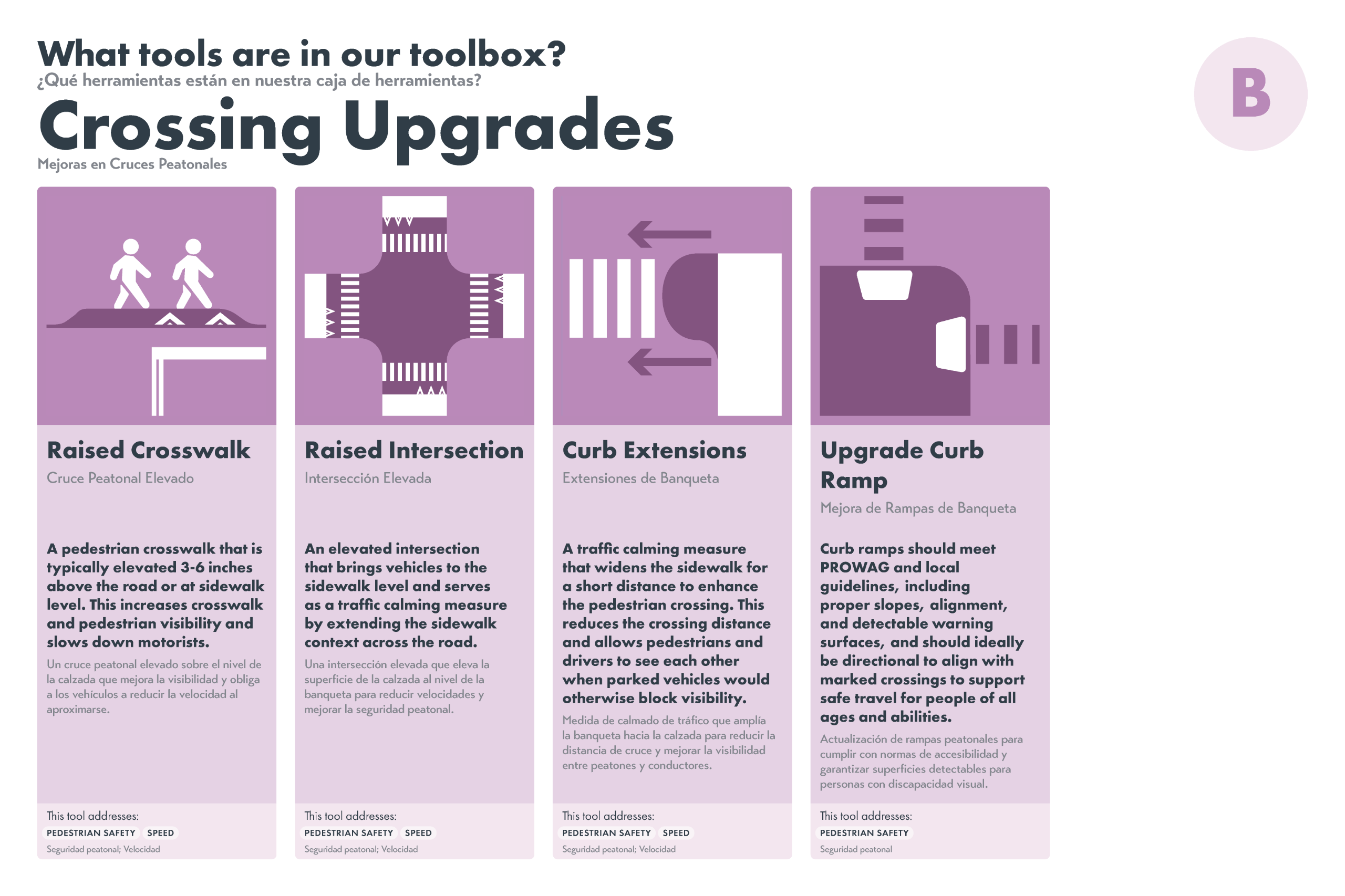
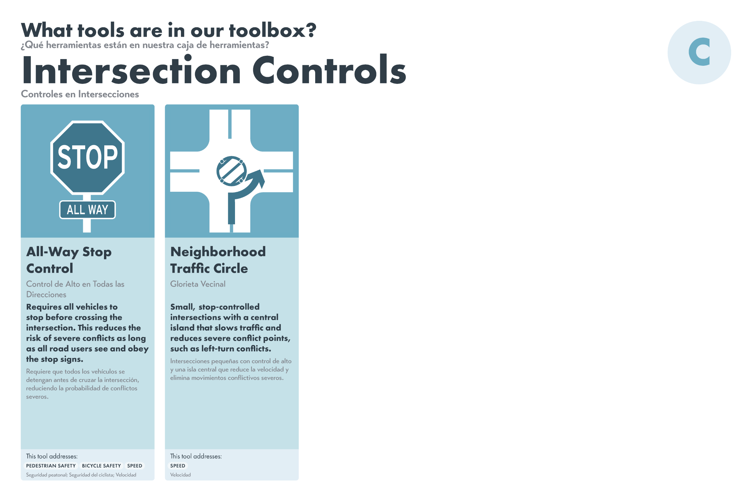
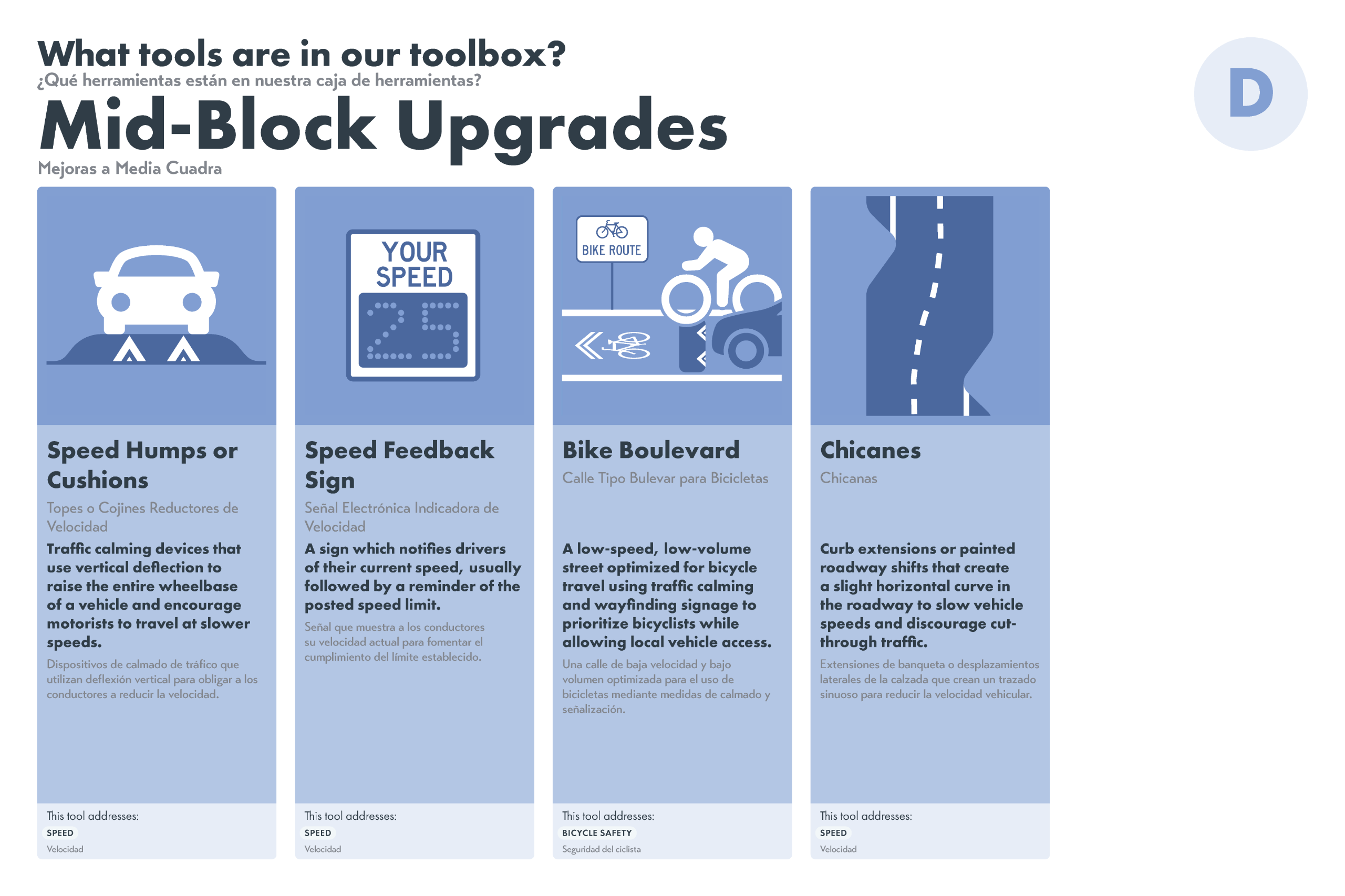
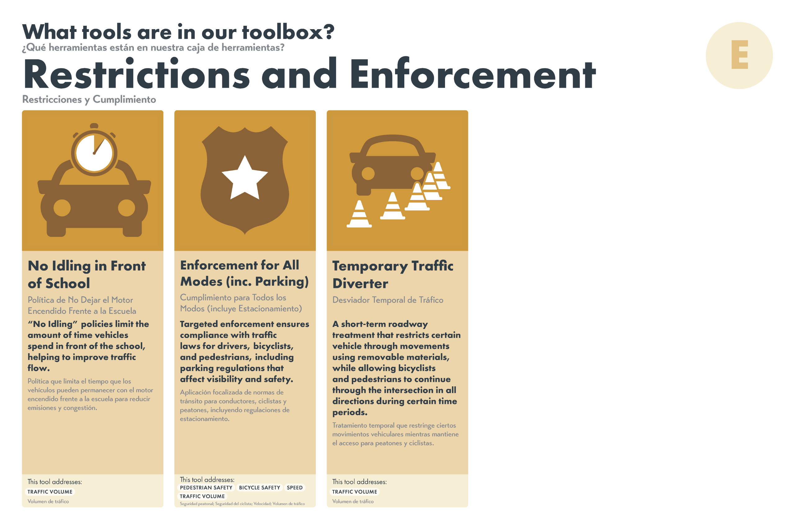
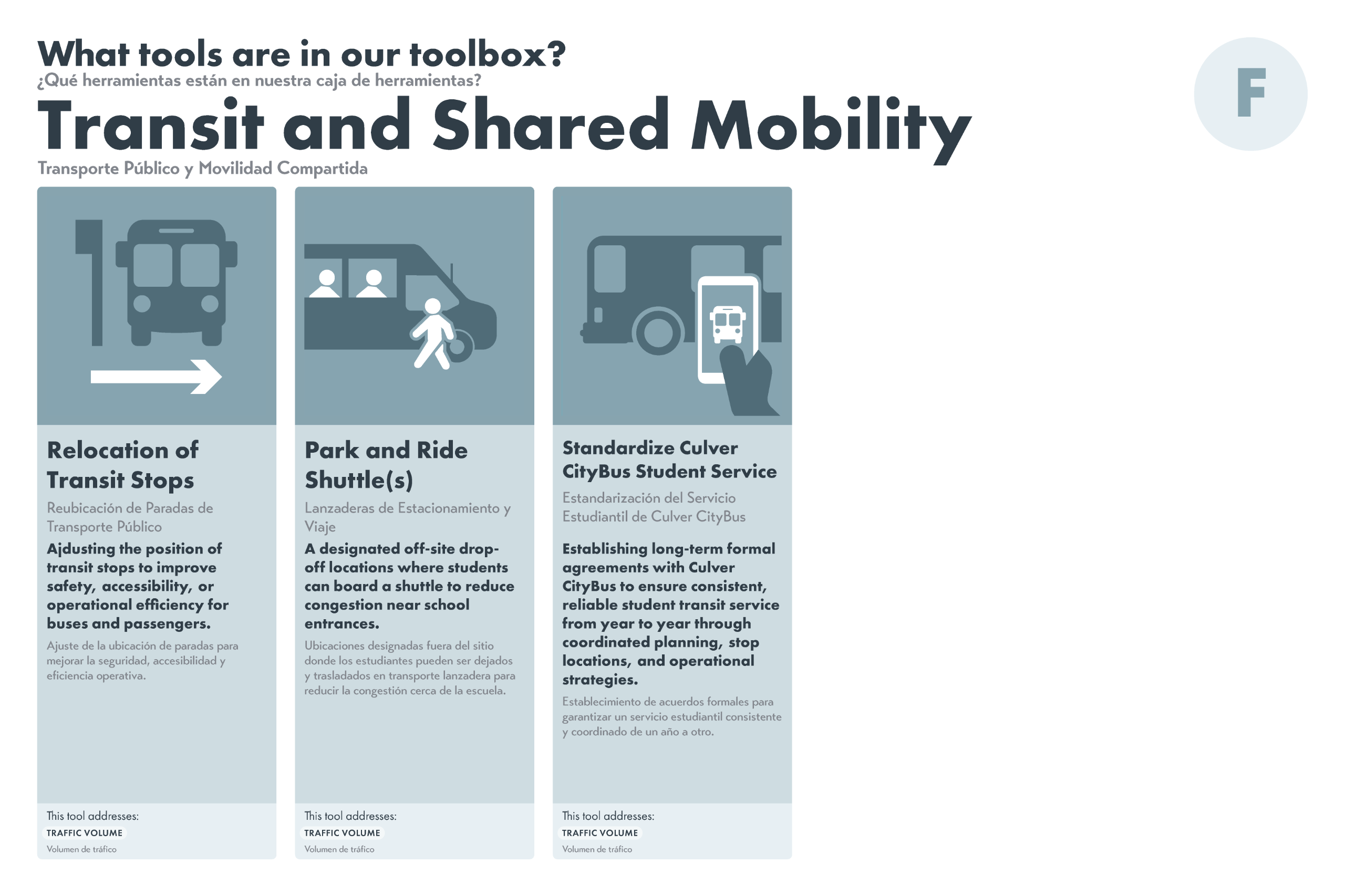
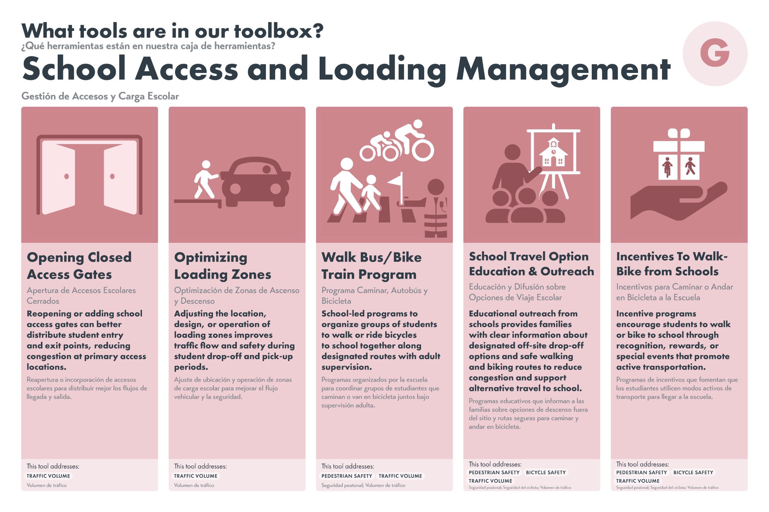
Step Two: What are Our Toolboxes?
Now, review the toolboxes to find out what kinds of tools each toolbox contains and how they relate to the current challenges...
Image 1 of 7
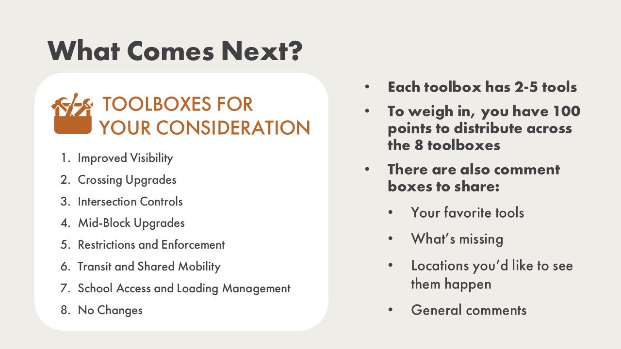
Step Three: Share Your Preferences
Now, use the survey to prioritize the toolboxes by distributing 100 points across the eight options (seven toolbox categories and “No Changes”).
Afterward, you can use the forms below to share feedback on specific tools you like, tools you think are missing, or provide any additional comments.
Pick Your Preference Activity (Closed)
Please click the link below and complete the toolbox prioritization activity.
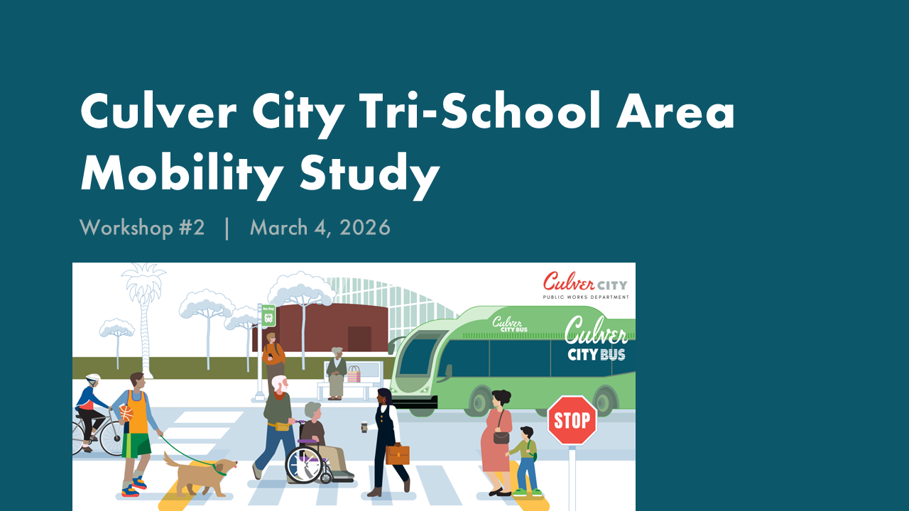
Engagement Round Two Workshop RSVP (Closed)
Engagement Round Two Workshop RSVP
Thank you to everyone who registered for and attended our first community workshop on March 4th! If you missed this workshop or have additional feedback, please feel free to complete the online engagement activities, which will be open until March 27th.
Round One Online Engagement Activities (Closed)
Round One Online Engagement (Closed)
Thank you to everyone who participated in the first round of engagement! We look forward to sharing what we learned as part of the next round of engagement in late Winter 2026.
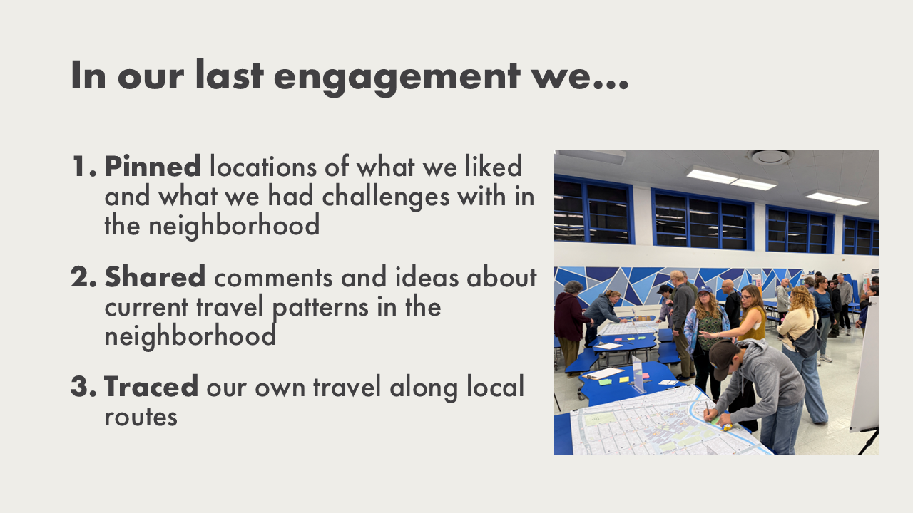
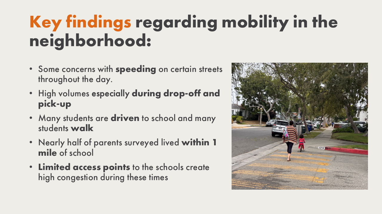
This engagement activity is the first step in gathering information for the mobility study. To kick off the project, we want to learn from the experiences of all who live, learn, work, and travel to and through the neighborhood.
Please join us in answering these questions:
1. How do you currently travel through the neighborhood?
2. What challenges do you experience when moving through the neighborhood?
3. What is working well in the neighborhood?
Project Documents
Project Documents
Traffic Counts
Traffic data was collected for this project in December 2025. Turning movement count data can also be viewed on the map at this website: https://culvercityca.data-point.io/
-
 Turning Movement Counts (by mode)Zip Archive (3.94 MB)
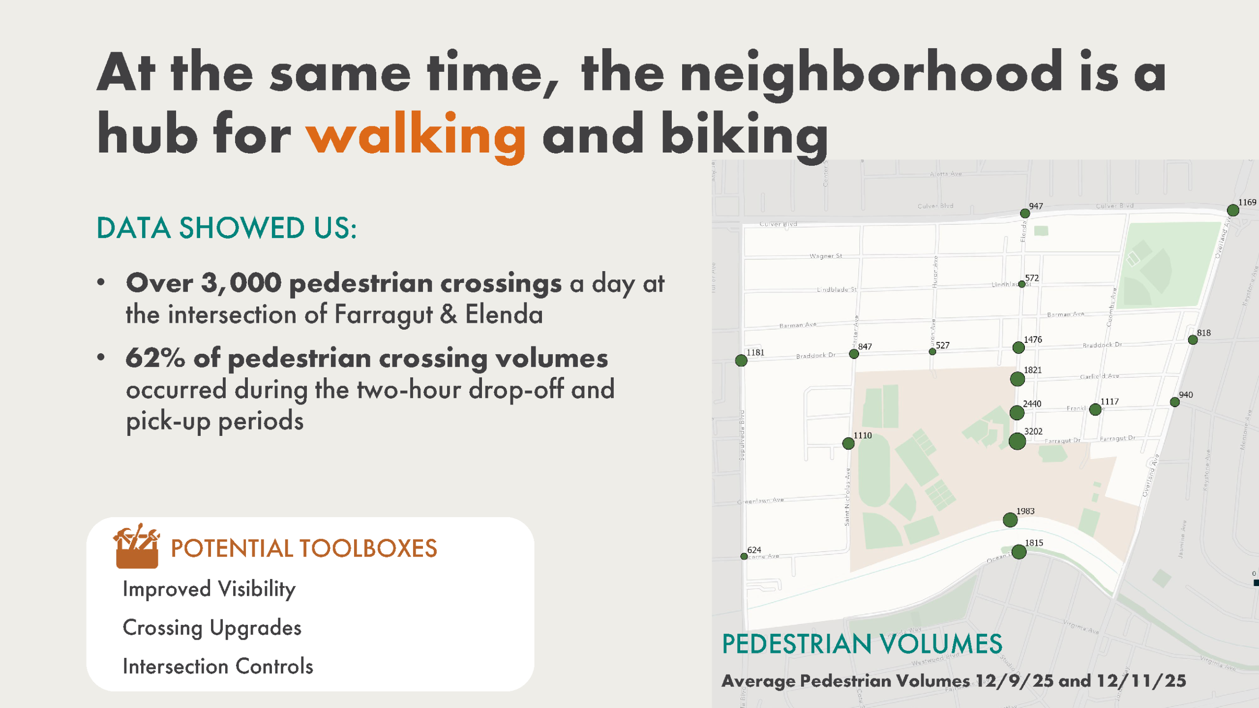
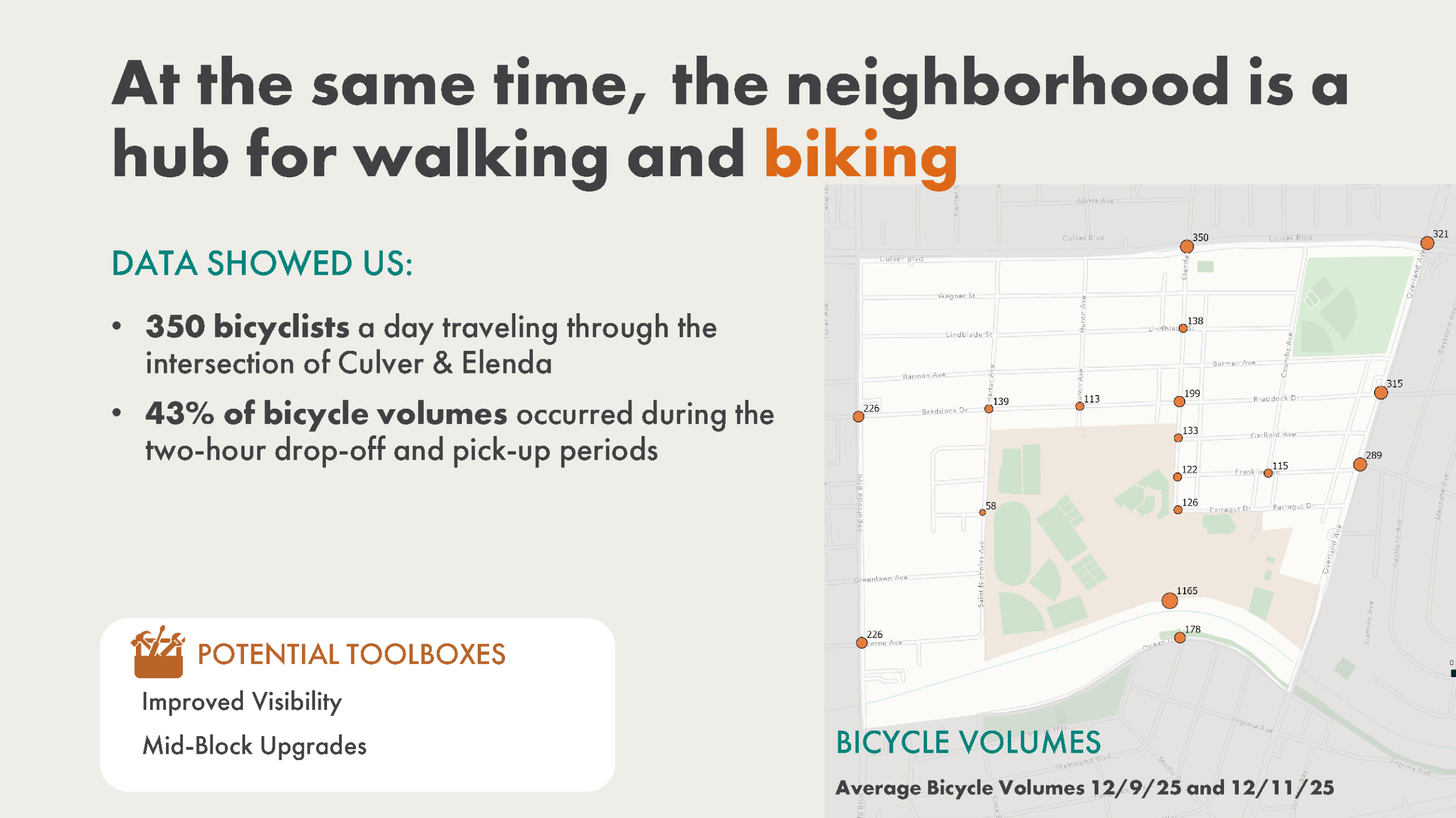
Turning movement counts by mode collected on Tuesday 12/9/25 and Thursday 12/11/25, with additional data at select intersections collected on Wednesday 12/10/25. Posted 1/28/2026.
-
Pedestrian Bicycle Counts (Ballona Creek Bike Path)Zip Archive (97.45 KB)
Pedestrian and bicycle counts at the entrance to the schools along the Ballona Creek bike path collected on Tuesday 12/9/2025 and Thursday 12/11/2025. Posted 1/28/2026.
-
Intersection Speed ReportsZip Archive (16.44 MB)
Intersection speed reports for data collected on Tuesday 12/9/25 and Thursday 12/11/25, with additional data at select intersections collected on Wednesday 12/10/25. Posted 1/28/2026.
-
15 Minute Corridor Speed and Volume ReportsZip Archive (4.58 MB)
15 minute corridor speed reports for data collected on Tuesday 12/9/25 and Thursday 12/11/25. Posted 1/30/2026.
-
60 Minute Corridor Speed and Volume ReportsZip Archive (2.89 MB)
60 minute corridor speed reports for data collected on Tuesday 12/9/25 and Thursday 12/11/25. Posted 1/30/2026.
-
Corridor Speed ReportsZip Archive (1.93 MB)
Corridor speed reports for data collected on Tuesday 12/9/25 and Thursday 12/11/25. Posted 1/30/2026.
Other Project Data
-
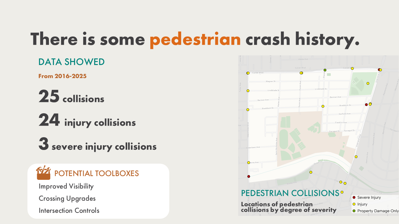
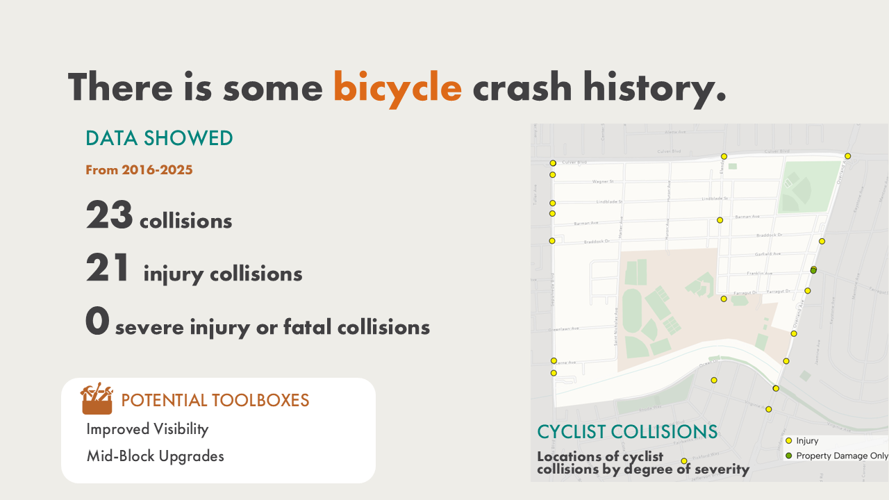
Culver City Collision Data 2016-2025Zip Archive (124.58 KB)
Collision data for Culver City from 2016-2025 filtered to the Tri-School Study Area. Provided by the City of Culver City. Retrieved October 2025. Posted 3/3/2026.
-
City of Los Angeles (Tri-School Area) Collision Data 2016-2025Zip Archive (14.23 KB)
Collision data for the City of Los Angeles from 2016-2025 filtered to the Tri-School Study Area. Downloaded from the California Crash Reporting System (CCRS). Retrieved January 2026. Posted 3/3/2026.
-
 Tri-School Area Trip Origin Distribution (Weekday Mornings)PDF (426.66 KB)
Map showing the origins of trips passing through the Tri-School Study Area during a typical Tuesday morning (7–9 AM, May 2025), as a percent of total trips. Downloaded from Streetlight December 2025. Posted 3/3/26.
-
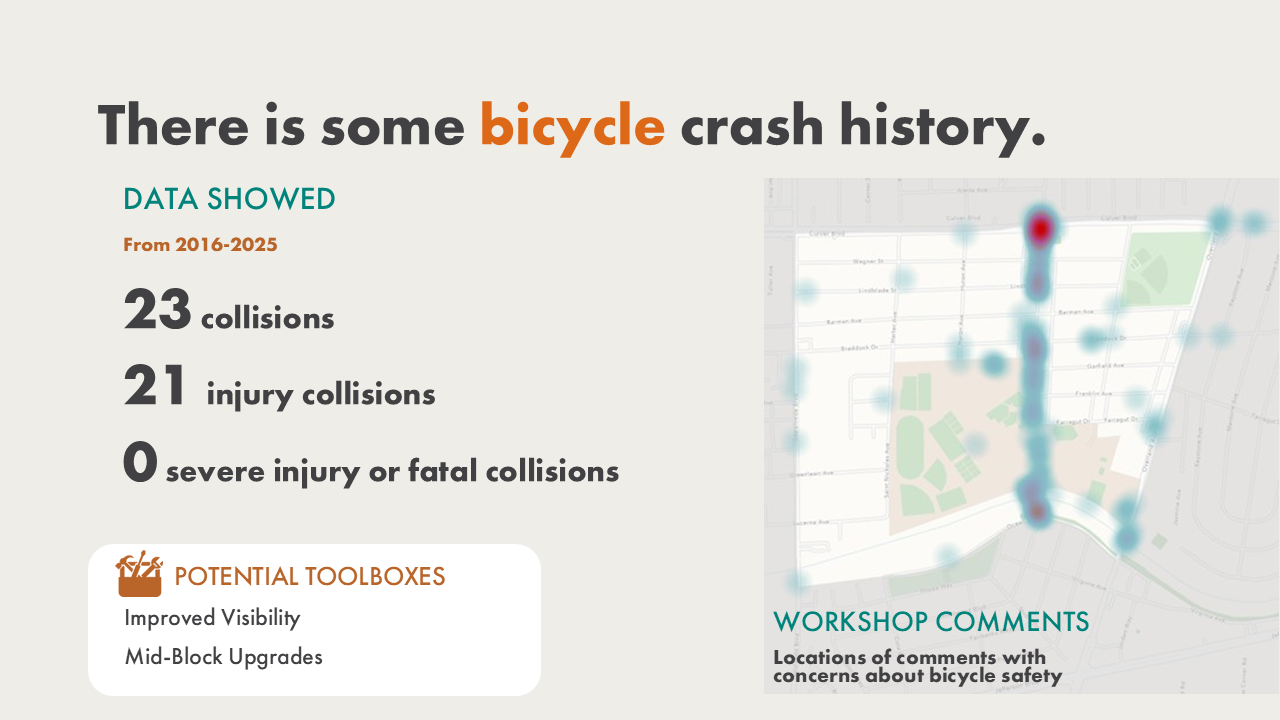
 Near-Miss DataMS Excel (103.23 KB)
Near-miss data collected on Tuesday 12/9/25, Wednesday 12/10/25, and Thursday 12/11/25. Posted 3/3/2026.
-
Culver CityBus DataZip Archive (374.34 KB)
Culver CityBus GoPass, Stop Level Data, and Trip-Level Ridership. Posted 3/3/2026.
Project Document Library
-
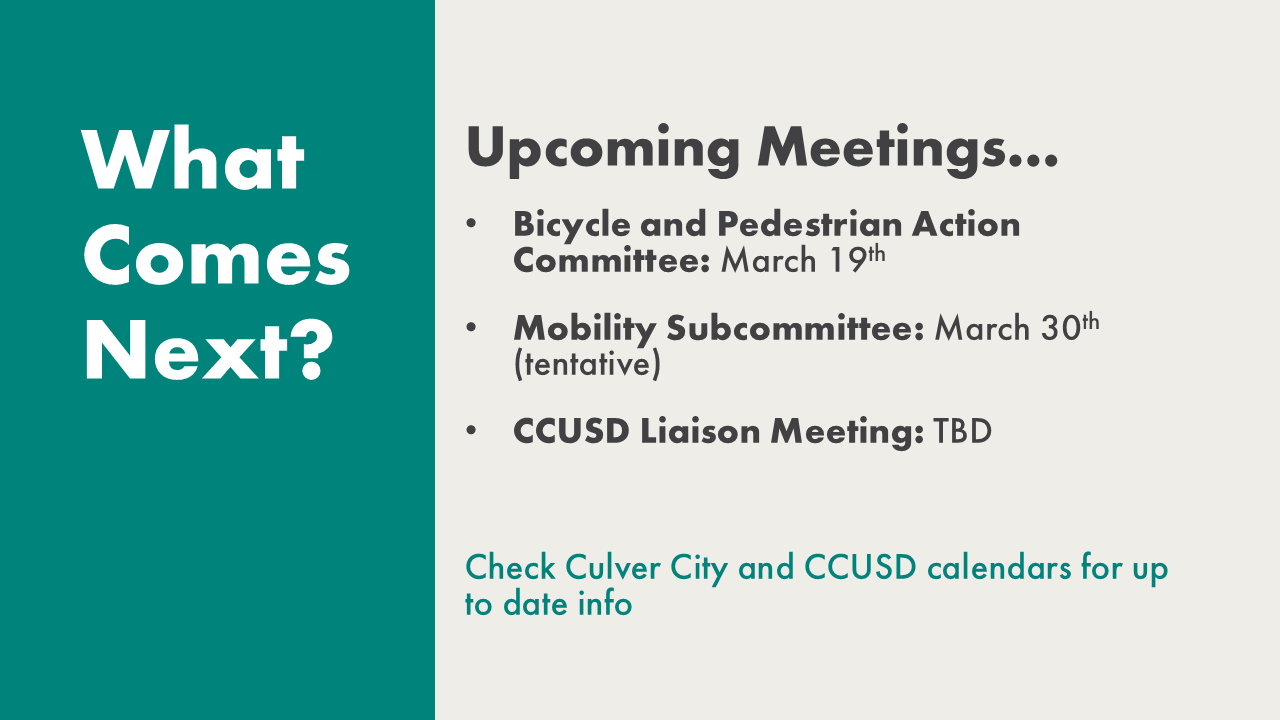
Presentation for 3/31/26 Culver City Mobility Subcommittee MeetingPDF (1.76 MB)
Posted 4/6/2026.
-
Presentation for 3/19/26 Bicycle and Pedestrian Advisory Committee MeetingPDF (1.78 MB)
Posted 3/30/2026. Updated 3/31/2026.
-
Request for Proposals for Tri-School Area Traffic StudyPDF (950.24 KB)
-
Staff Report: Tri-School Traffic Study Professional Services AgreementPDF (167.20 KB)


