About
The Foster City Bicycle and Pedestrian Master Plan (Plan) is an important step towards enhancing the existing walking and biking network and identifying opportunities to create new connections. The Plan aims to make walking, biking, and rolling in Foster City safer, more convenient, and accessible for everyone. The following key goals will guide the development of the Plan:
- Expand Access:
- Provide residents with safe and convenient infrastructure regardless of age and ability.
- Safe Routes to Key Destinations:
- Prioritize safe and comfortable routes to schools, parks, and other everyday destinations to support active transportation.
- Context-Sensitive Design:
- Develop solutions that reflect the thoughtful design, needs, and constraints of each neighborhood.
- Adaptability and Resilience:
- Plan for future needs by creating flexible infrastructure and policies that can respond to evolving travel patterns and community input over time.
The Process
Welcome to the outreach hub for the Plan! This site is for updates, events, and ways to get involved. The project team is planning three phases of outreach, each with new opportunities to share your ideas, both online and in person. As the project moves forward, the survey will evolve to match each phase, so check back for updates!
To learn more about the outreach phases, visit the FAQs below.
Below are two interactive map-based surveys designed to gather your input on proposed future networks in our community.
- Survey 1: Proposed Future Bicycle Network
- Survey 2: Proposed Future Pedestrian Network
We encourage you to explore both maps and share your feedback. Additional information about the proposed improvements is posted below the maps. Your feedback will inform the development of the final networks that will be included in the City’s Bicycle and Pedestrian Master Plan.
About the Proposed Future Bike Facilities
The following describes standard bike facility classifications. The facilities in the proposed future network were selected based on speed and volume data in alignment with Caltrans Design Information Bulletin 94 (Complete Streets: Contextual Design Guidance).
-
Class I (Shared Use Path)
Shared, bidirectional space for people walking, biking, and rolling.
-
Class II (Bike Lane)
Striped lane for bikes, sometimes including buffer space.
-
Class III (Bike Route)
Shared lanes for cars and bikes, sometimes with traffic calming features.
-
Class IV (Separated Bikeway)
Dedicated space for bikes with physical separation from cars.
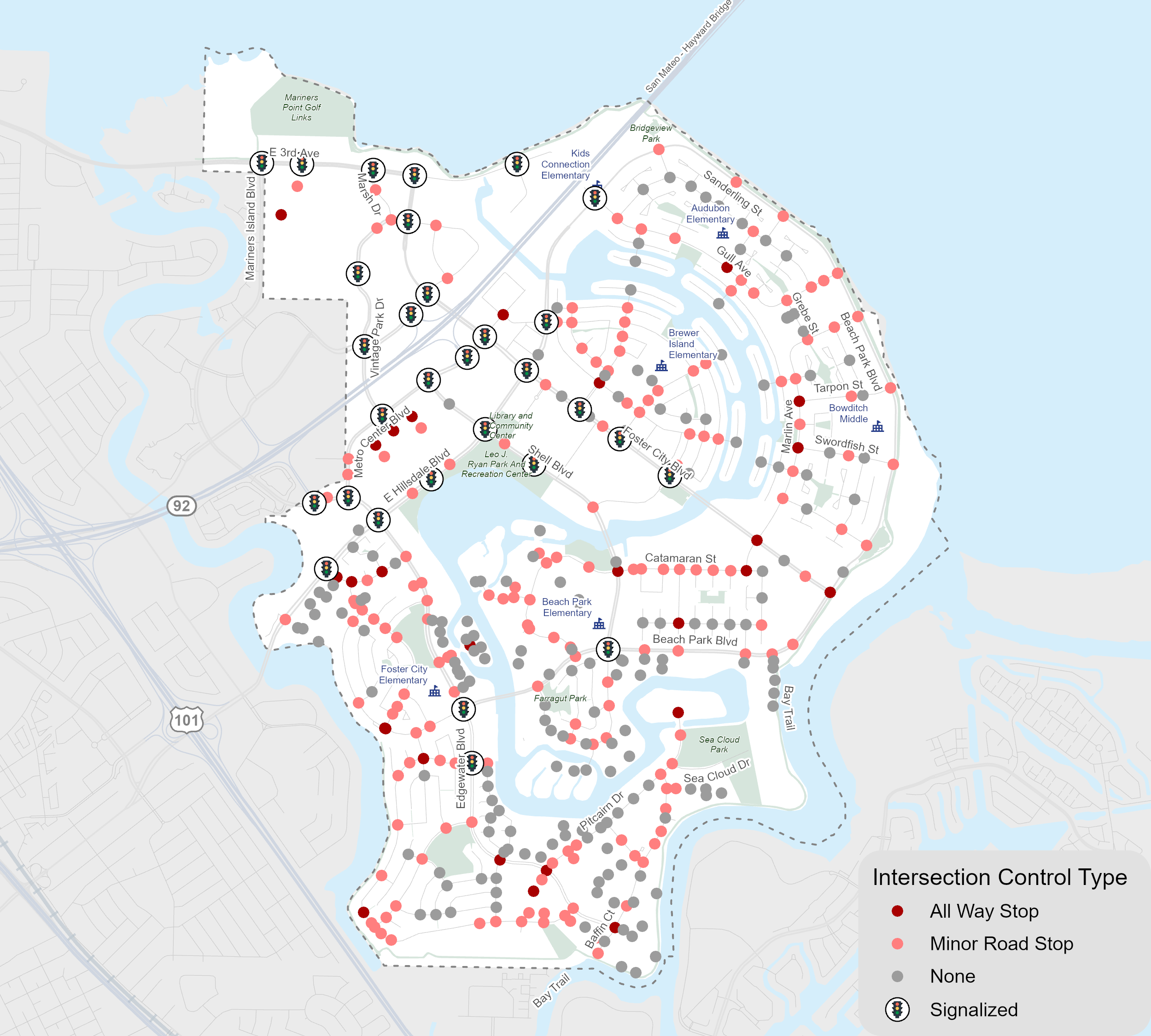
About the Priority Crossings for Improvements
The following describes the recommended improvements based on the intersection control type (traffic signal, stop controlled on uncontrolled). This is a menu of options that can be applied depending on contextual factors. These recommendations are aligned with industry best practices.
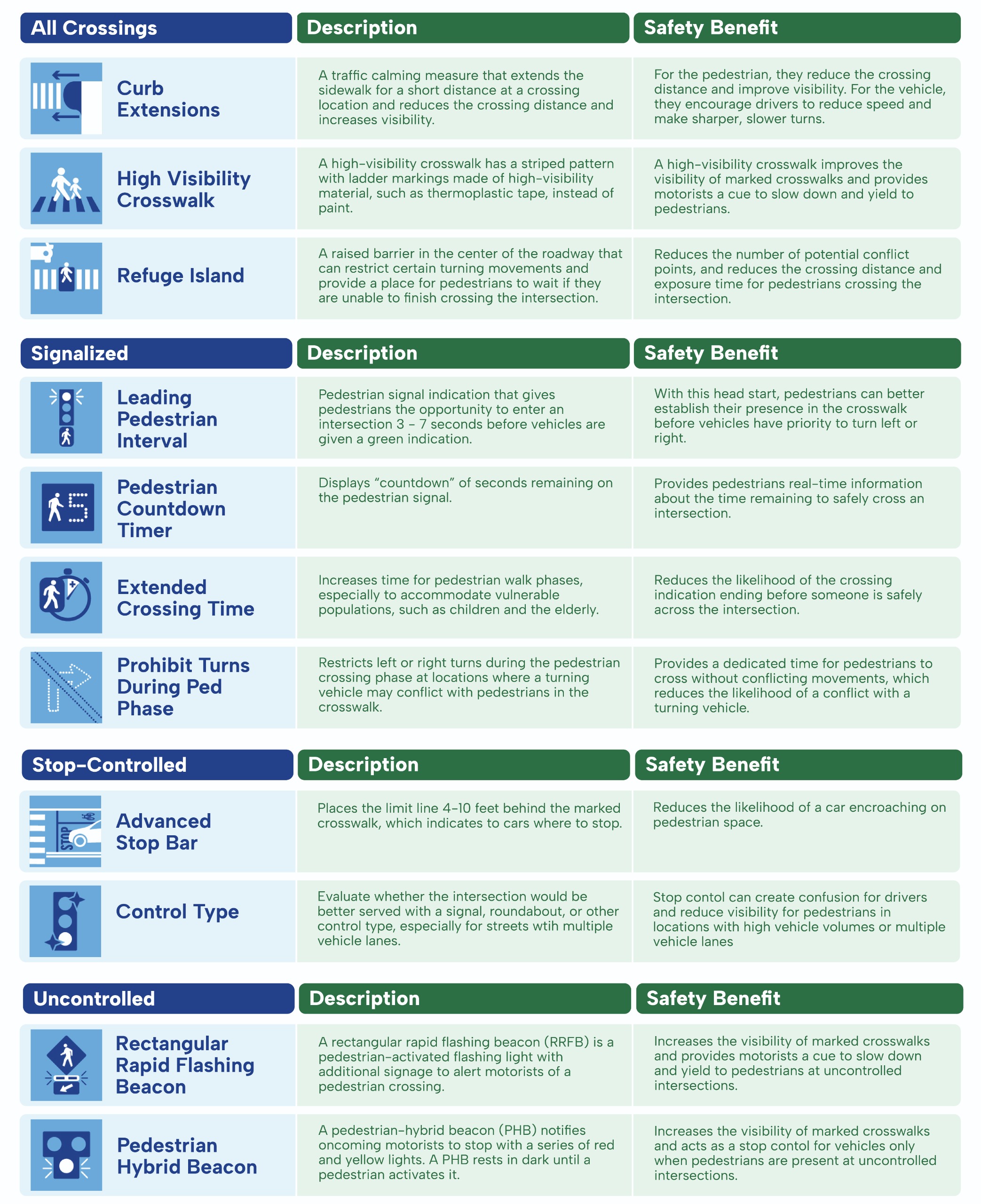
The map below provides information about the intersection control types in Foster City.